Exploring the historic landscape – a series of self-guided walks
Wales has long been a popular destination for walkers. Many people head for the rugged peaks of Snowdonia and the majestic Brecon Beacons, but overlook the equally picturesque and challenging terrain in between. The Clwyd-Powys region of mid- and north-east Wales has much to offer. CPAT has developed a series of self-guided walks for those walkers with an interest in history and archaeology.
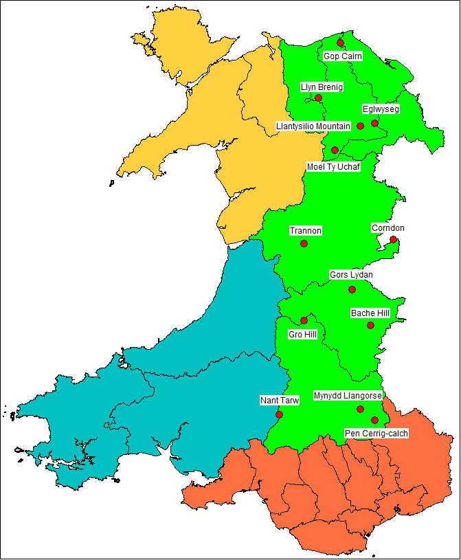
These focus on prehistoric burial and ritual monuments, principally the stone circles, standing stones and burial cairns dating to around 2300-1200 BC.
Each walk can be downloaded as a PDF, which includes a detailed description of the walk with information about the history and archaeology, together with an abbreviated version and map on a single page.
Using the guides Each of the walk descriptions are provided as guides only and should always be used in conjunction with a suitable map, such as the Ordnance Survey 1:25,000 (Explorer or Outdoor Leisure) series. The relevant maps are given in the individual guides. The walks will take you into remote upland areas and you should ensure that you are well equipped – with sufficient water, a compass and a fully-charged phone, as well as appropriate clothing – and have checked a weather forecast before setting out. The Clwyd-Powys Archaeological Trust is not responsible for your actions when using these guides.
The Countryside Code Be safe – plan ahead and follow any signs. Leave gates and property as you find them. Protect plants and animals and take your litter home. Keep dogs under close control. Consider other people
The Guides Trannon Pen Cerrig-calch Nant Tarw Llangorse Moel Ty Uchaf Llyn Brenig Moelygaer / Llantysilio Mountain Gro Hill Gop Cairn Gors Lydan Eglwyseg Corndon Bache Hill