
Newtown Mound, Powys
During the earlier part of 2022, on behalf of Newtown and Llanllwchaiarn Town Council and Cadw, our team undertook an archaeological evaluation of Newtown Mound.
Ongoing work under a townscape initiative by Newtown Town Council is improving the condition of, and public access to, the monument, removing scrub and saplings from the grassed ditches and undertaking management work to the large trees around its summit. The mound is in fair condition but there is some heavy erosion to the south-east corner and other areas of the summit created by generations of children using it as a BMX ramp and stunt ground. Some of the erosion that occurred around the mounds summit is believed to have truncated the remains of a medieval embankment.
The mound is a Scheduled Monument (MG160) and lies to the south-west of the centre of Newtown, on the north-western side of Park Street, beside the council offices. In summary, the monument is a large, 5m high flat-topped mound with a wide surrounding ditch in the grounds of the former Newtown Hall. Assumed to be a motte and bailey castle it is of unusual form being almost a ‘D’ shape in plan with a very broad summit and is undocumented until the post medieval period. Theories as to its origins include the base of a late castle founded by the Mortimers alongside their new borough on gaining the area in the 1280s, a 17th century Civil War earthwork, and some form of prospect mount for Newtown Hall. With regards to the latter, a polygonal brick summerhouse is shown on the western edge of the summit on early maps, although the mound appears too large to have been newly created as a garden feature.
As part of the evaluation CPAT were assisted by a team of volunteers who were engaged in an outreach programme that included both on site excavation and finds processing. The investigations on Newtown Mound revealed evidence for significant archaeological deposits, in situ, dating from the medieval period (14th century), English Civil War garrison (mid-17th century) and the later re-landscaping undertaken in the 19th century. Numerous artefacts dating from these periods were recovered.
The remains of the polygonal building (summerhouse), marked on late 19th century O.S mapping, were not identified during the work.
The excavation also investigated a linear earthwork bank of unknown origin, close to the mound. The earthwork survives to a height of 1.9m and the width is approximately 7.5m. An accompanying ditch, recorded along the western side, could be at least 5-6m wide and 2-3m deep. The limited investigations also demonstrated that the monument is not of 18th century origin but rather of earlier design, possibly part of the Newtown defences dating from the English Civil War (mid-17th century period) or possibly of earlier, medieval, origin.
The response to the community excavation from the volunteer experience point of view has been overwhelming. Volunteer numbers engaging in the project, in excess of 115 people over a period of 5 weeks, is one of the highest participation rates ever to engage in a CPAT Outreach programme. The project delivered the opportunity for volunteers of mixed ability to engage in both field craft and/or indoor workshops in such a way that allowed them to aid and contribute to the greater understanding of the earlier, and hitherto lesser studied, heritage of Newtown.
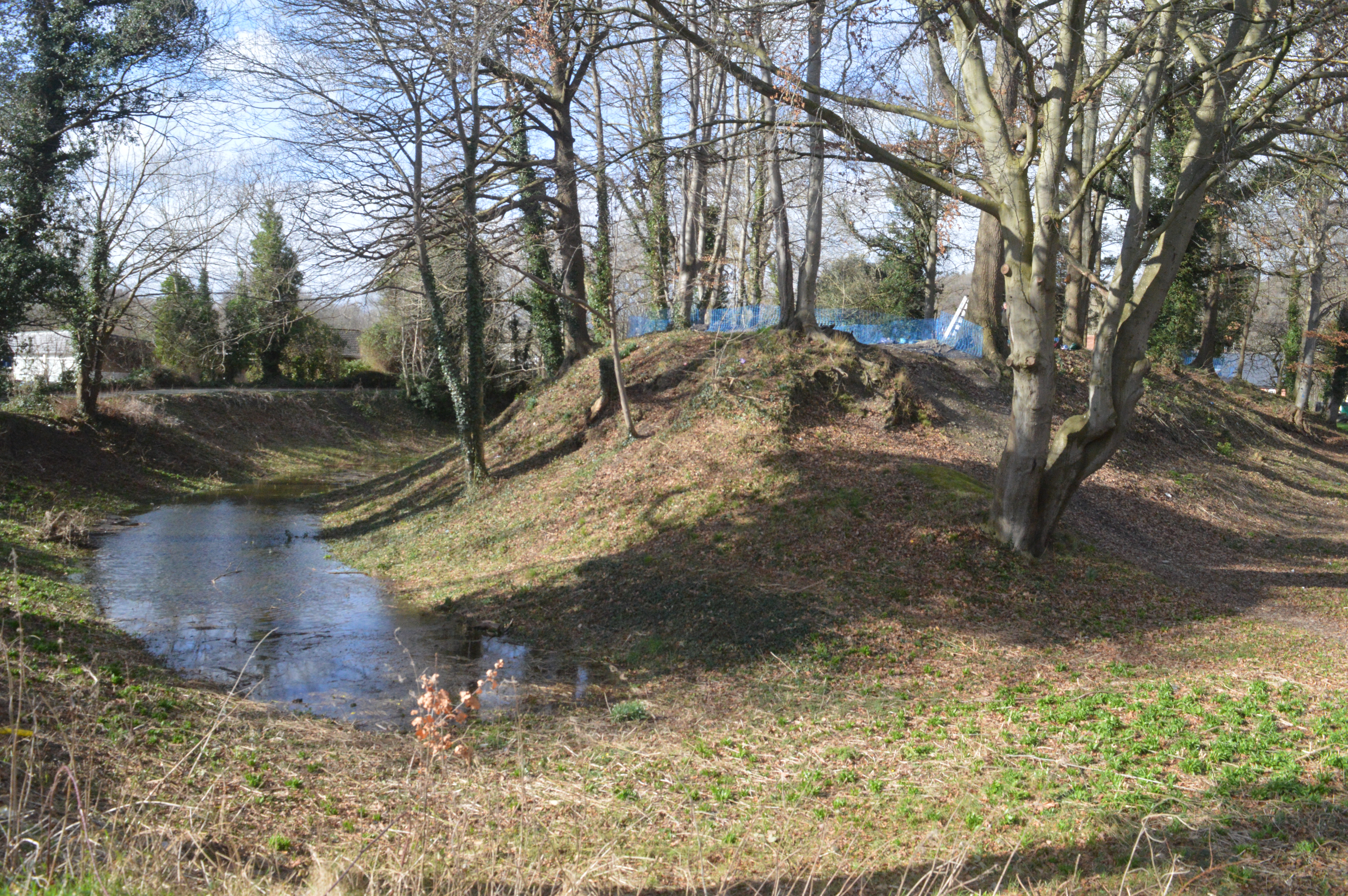
Newtown Mound and moat, viewed from the south-east (CPAT Image 4890-0043)
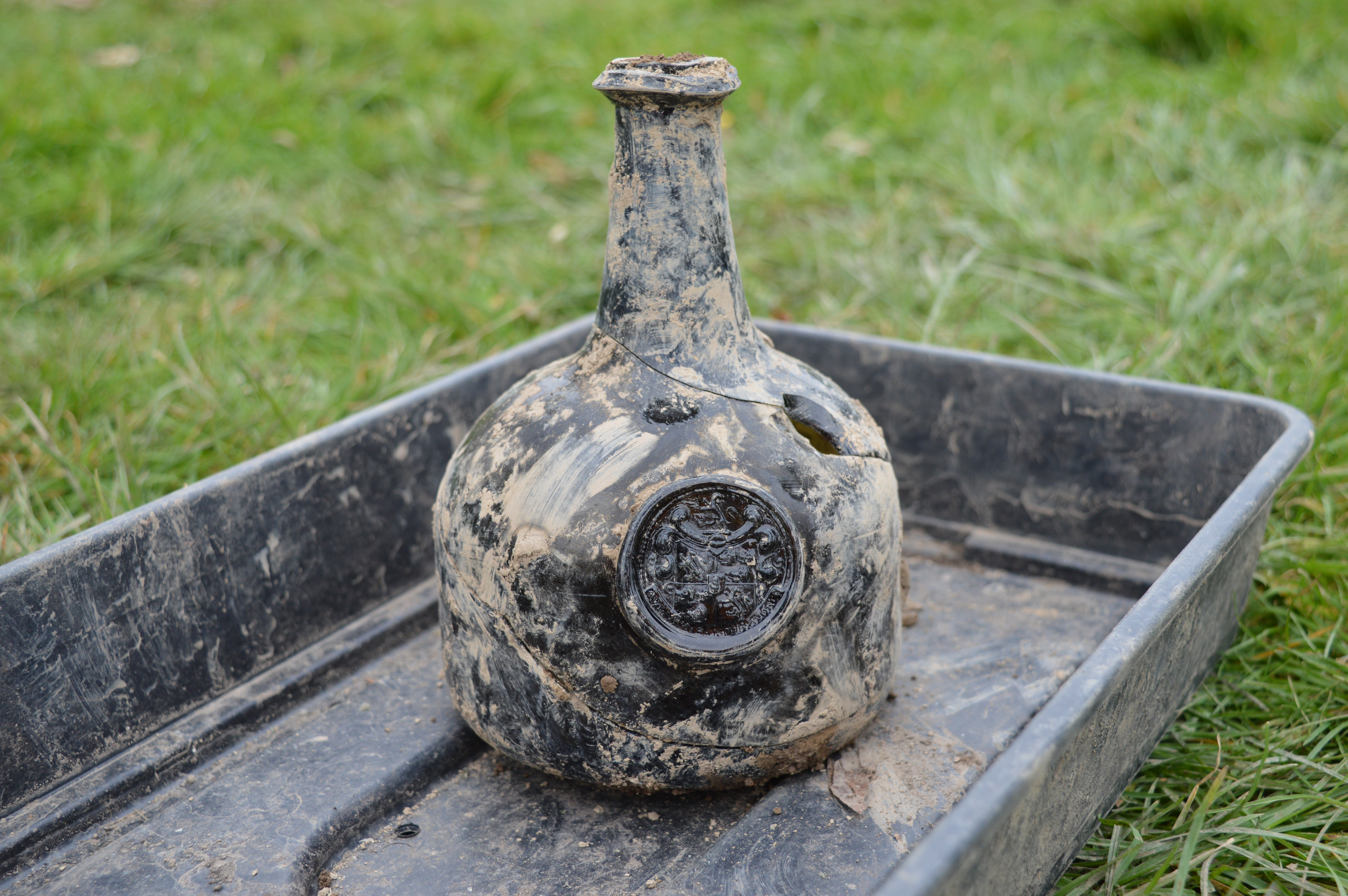
An 18th-century bottle discovered during the excavations. The bottle bears a crest with the motto AVI NUMERANT UR AVORUM – the motto of the Pryce family of Newtown Hall.
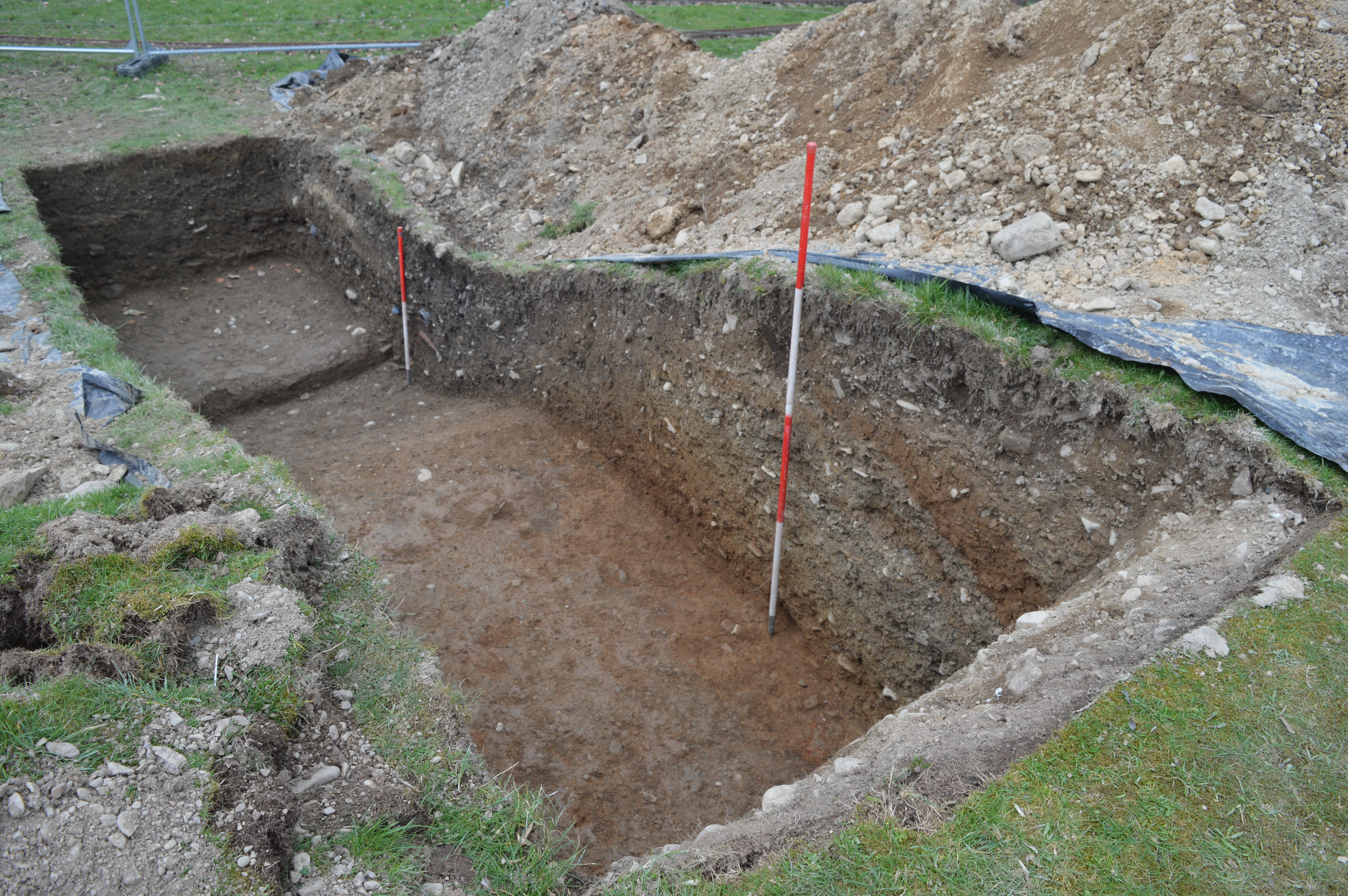
A section through the linear bank, viewed from the north-east (CPAT Image 4980-0134)
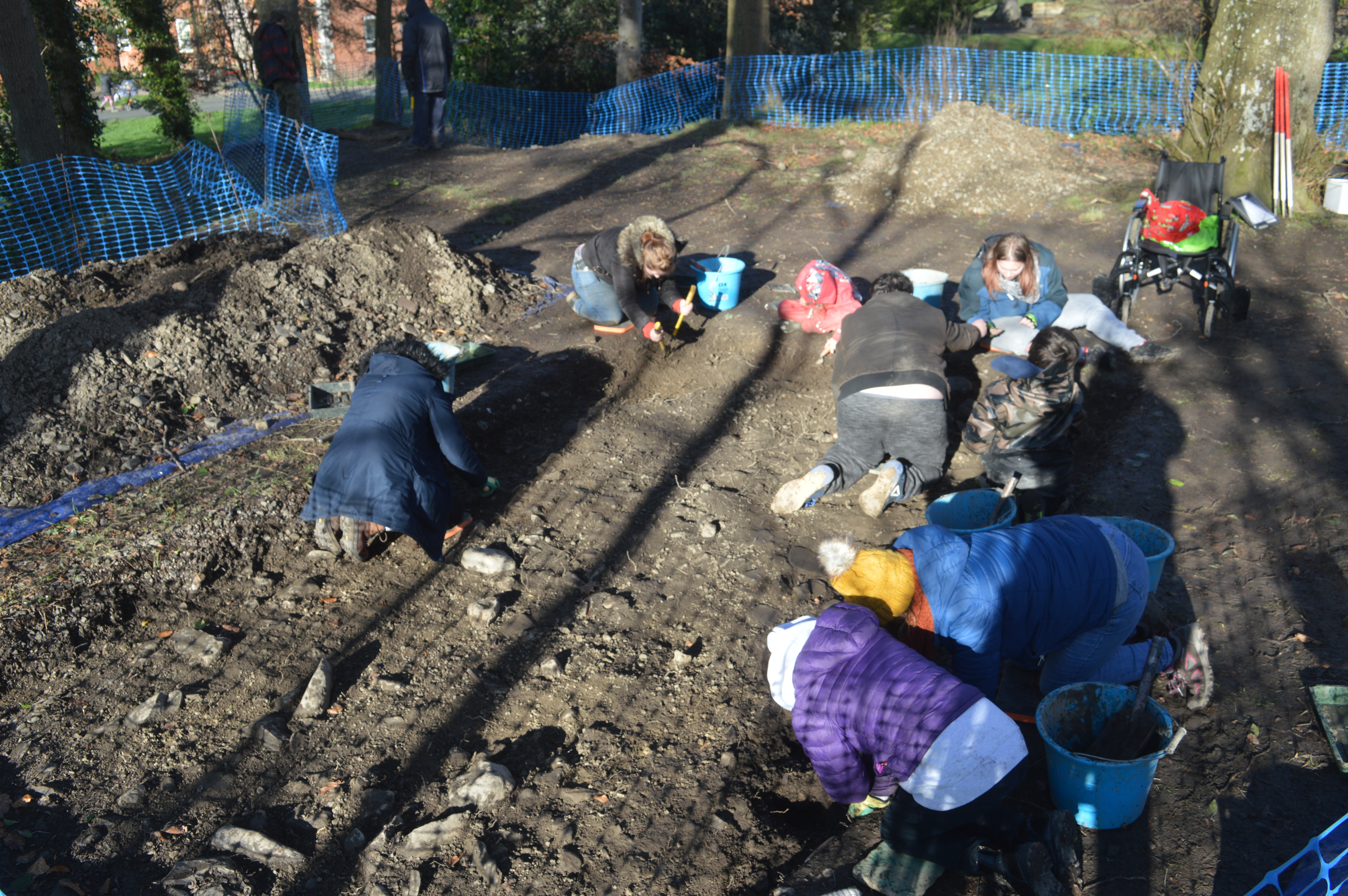
Volunteers hard at work (CPAT Image 4980-0057)