Climate change and the coastline
We are all familiar with scenes of houses balanced precariously close to ever receding cliff edges, but what other sites are at risk from coastal erosion? The Welsh coastline is a hot spot for a range of historic assets, such as submerged prehistoric landscapes, promontory forts, air crash sites, shipwrecks and pill boxes, to name a few.
In an attempt to combat the effects of coastal erosion, many local authorities in Wales have come up with plans to protect their coastlines, introducing schemes for improved coastal flood defences. While these schemes have their benefits, they require significant construction work and the potential impact to the historic environment must be considered at the project planning stage.
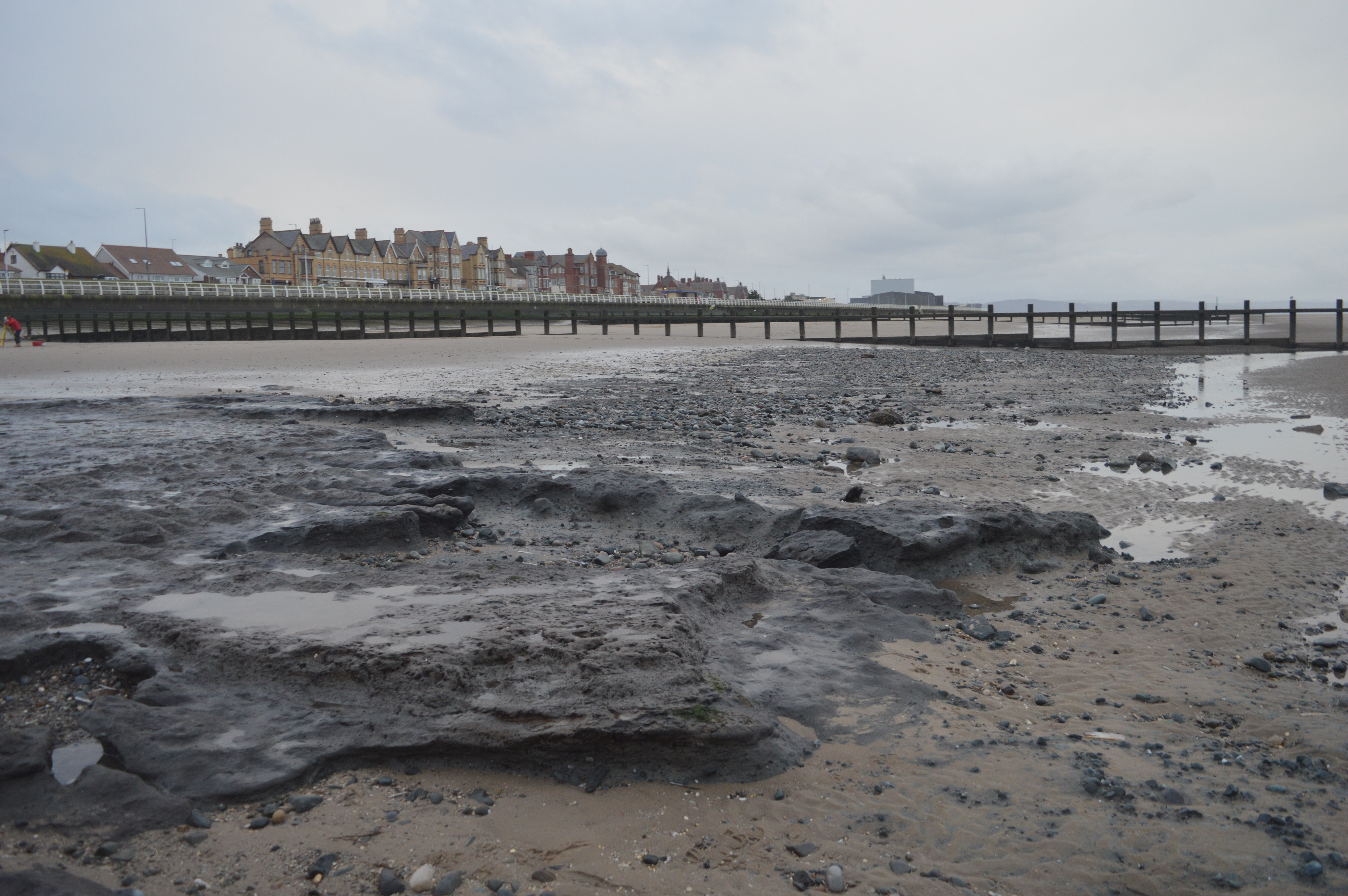
CPAT has most recently been involved in the coastal flood defence scheme at Rhyl and Prestatyn, specifically, the notorious erosive headland known as ‘Splash Point’ and the beach in front of Rhyl/Prestatyn Golf Club. Owing to the ever-changing tidal action in this area the sand coverage drifts up and down the coastline especially after severe weather storms. This occasionally strips away the sandbanks revealing old wooden structures and the preserved remains of a long submerged prehistoric landscape in the form of peatland and woodland.
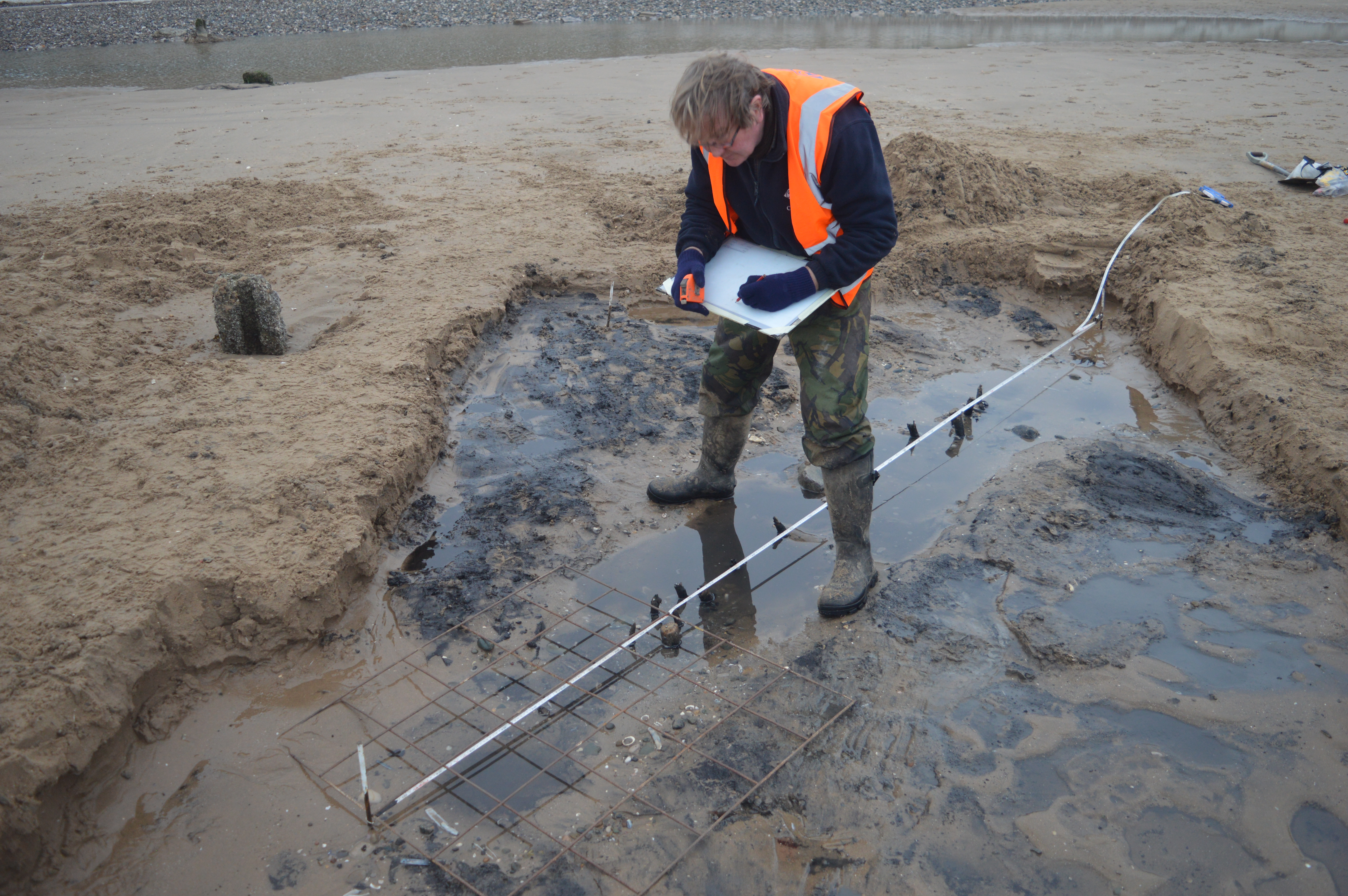
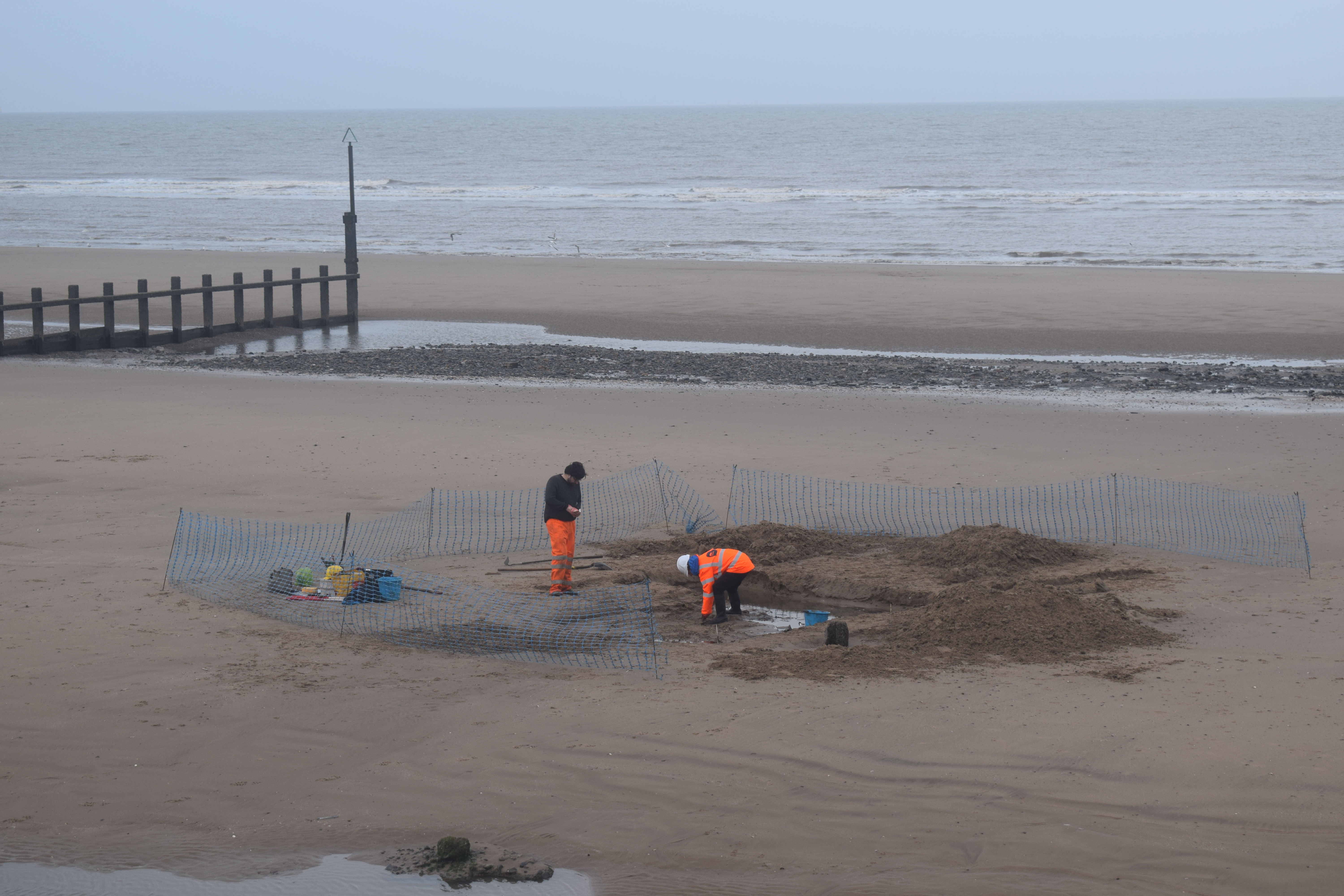
In advance of the groundworks required to build the new sea defences between Rhyl and Prestatyn, CPAT, along with University of Wales Trinity Saint David, Lampeter were tasked with recording, sampling, and excavating any archaeological features that have been exposed along the beach front here. The groundworks would, for the most part, inevitably remove some of the exposed features although wherever possible the construction methodology tried to mitigate/preserve the archaeology by importing huge amounts of sand to create a protective causeway on the beach for the daily movement/access of plant machinery.
Out team have quite literally been working at the mercy of the natural environment here, which has dictated when we can work and latterly washed our efforts away with the incoming tide! In 2020 we investigated a series of wooden structures built from stakes that had been shaped with metal tools. The structures were first recorded in 2013 and had putatively been interpreted as fish traps, however until further analysis is completed, we cannot be certain of their purpose. What was clear from our excavations was that the dynamic erosion and redeposition processes on the beach have impacted significantly on the remains, reducing their height by at least 50% between 2013 and 2020.
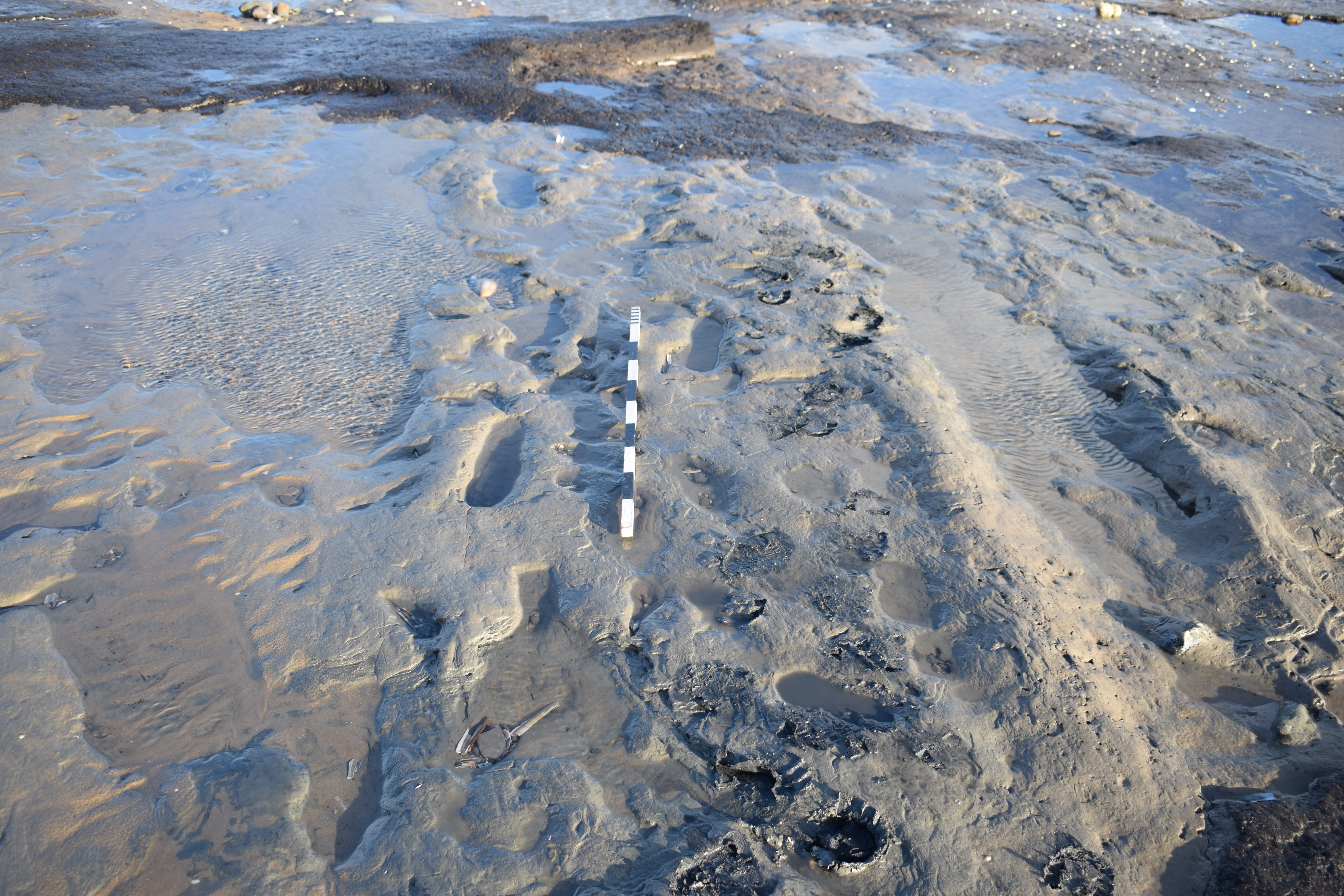
Further work at the beach in the earlier part of 2021 recorded anthropogenic footprints with multiple tree stumps and recumbent trees/logs. The footprints were sealed by the alternating layers of peat, demonstrating how the sea has, over time, periodically made inroads into the headland, then retreated, leaving the landscape to recover and new forestry to rejuvenate. It was also noted at this time that many of the features that had been recorded in 2020 were no longer visible owing to sand coverage.
Out work here is ongoing and scientific analysis by University of Wales Trinity Saint David, Lampeter continues.