
SURVEYS
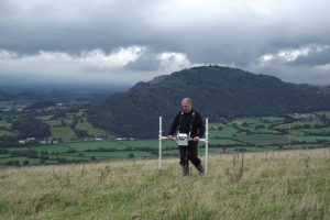 | 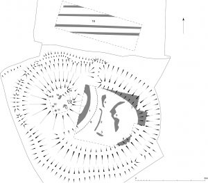 | |
| Geophysical survey being undertaken on the Long Mountain, near Welshpool (Powys). | Earthwork and geophysical survey results from Tomen y Rhodwydd motte near Llandegla (Denbighshire). |
Geophysical Survey
The use of geophysical survey has become widespread as part of the assessment process for larger developments and has the potential for revealing subsurface archaeological remains for which no visible trace now survives. CPAT has close links with a number of specialists in geophysical survey who can provide competitive surveys using a range of techniques.
Topographical Survey
CPAT has extensive experience in undertaking detailed topographical surveys of archaeological sites and wider landscapes. Over the last 20 years our staff have undertaken a wider range of surveys, including prehistoric stone circles, Iron Age hillforts, Roman forts, deserted medieval settlements and extensive 19th-century mining landscapes.
Interpretation of earthwork remains is a key element of all topographical surveys, and this can often be aided by evidence from desk-based research, such as early maps and aerial photographs. In other instances the results may be combined with those from geophysical survey to provide a more detailed analysis of a particular site.
For any enquiry about commercial services, please contact our Principal Archaeologist Tim Malim in the first instance. Telephone: +44 (0)1938 552002 /+44 (0) 7977 235984
Please have a look at some of the other commercial services we provide. Alternatively you can see some of our recent project highlights.