
Cymraeg / English
|

|
Historic Landscape Characterisation
The Vale of Clwyd
The following description, taken from the Historic Landscapes Register, identifies the essential historic landscape themes in the historic character area.
|
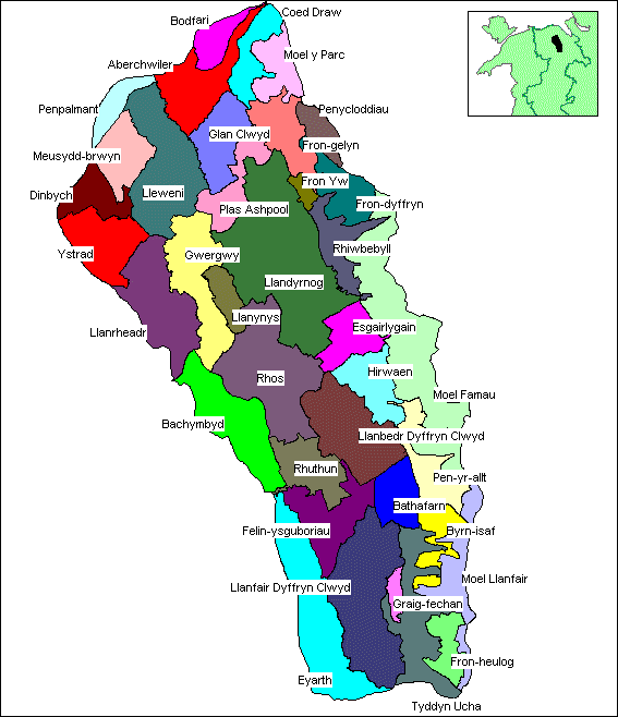
Character areas defined in the Vale of Clwyd Historic Landscape
|
The Vale of Clwyd dominates the geography and forms one of the most distinctive landscapes of north east Wales. Containing the River Clwyd in its broad flat base, it runs for about 30km north from the medieval town of Ruthin to join the coast at Rhyl. The valley floor is low, being nowhere more than about 40m above sea level. On the east, the vale is bounded by the edge of the Clwydian Hills which rise steeply to about 300m above sea level, their summits commanding spectacular prospects of the valley floor below. The western side rises more gently towards the Denbighshire uplands some 7km away. The best surviving and most complete, typical historic part of the vale identified here lies mainly south and east of the medieval town of Denbigh.
Early man inhabited the twin cave sites at Cae Gwyn and Ffynnon Beuno, Tremeirchion, where animal bone and human Palaeolithic tool-bearing deposits have been found. However, the most striking archaeological monuments in this landscape are the Iron Age hillforts of Foel Fenlli, Moel y Gaer (Llanbedr Dyffryn Clwyd), Moel Arthur, Penycloddiau and Moel y Gaer (Bodfari) which form part of a defensive chain of sites crowning the summits of the Clwydian Hills. Even as individual, often quite large sites (Penycloddiau encloses an area of some 21ha), they are impressive, but together they form a unique group of hillforts in Wales that demonstrates the intimate relationship in landscape of natural landform and human territory.
Although there has been little modern excavation on any of the sites, current understanding suggests that each hillfort would have been the focal point of a well-defined territory extending across the vale beneath, and over the uplands to the east, so that each fort would have access to the same range of natural resources. The upland area of the Clwydian Hills is mostly rough grazing, but the valley bottom is, by contrast, rich agricultural land with enclosures encroaching onto the western slopes of the hills. Little is known at present of the ordinary settlements associated with the hillforts, but presumably they would have been densely concentrated along the fertile valley bottom, but now buried or obliterated by later activity. This is suggested by the crop-mark site discovered from the air at Tan Dderwen, east of Denbigh, where recent excavations have yielded evidence of activity from the Mesolithic, Bronze Age and Dark Ages.
Settlement within the vale is dominated by the medieval towns of Denbigh and Ruthin. Recent excavations in Ruthin, however, have suggested an earlier origin, with parts of a Romano-British settlement and possible Roman fort being revealed on the eastern fringes of the town. Ruthin's medieval street pattern is still evident and parts of the castle and town defences remain intact. The town also has a fine collection of vernacular architecture represented by distinctive buildings in limestone, red sandstone or half timbered styles. Like Ruthin, Denbigh also retains much of its medieval character, including the castle and town defences, and is a good example of an Edwardian period walled town. In the centre of the vale lies Llanynys, now a small hamlet, but originally a clas foundation (a unit of administration based on medieval monastic settlement) preserving vestiges of medieval field systems. It is also noteworthy as the site of the 9th century Llanfor of the early Welsh stanzas, Canu Llywarch Hen.
The landscape has been much affected by the influence of various medieval and later parks and estates, such as for example, Clwyd Hall and Llanrhaeadr Hall. To the east of Ruthin lies Bathafarn Park, a medieval park of the Lordship of Ruthin. A document of 1592 describes the boundaries, the character of the park and the evolution of the landscape which may still be traced today. Several parishes on the slopes of the Clwydian Hills have their 19th century Parliamentary Enclosure landscapes well-documented. They border, and contrast with, the generally earlier, hedged agricultural landscape of the valley floor.
 The Natural Landscape The Natural Landscape
 The Administrative Landscape The Administrative Landscape
 Settlement Landscapes Settlement Landscapes
 Agricultural Landscapes Agricultural Landscapes
 Transport and Communications Transport and Communications
 Industrial Landscapes Industrial Landscapes
 Defended Landscapes Defended Landscapes
 Ornamental and Picturesque Landscapes Ornamental and Picturesque Landscapes
Character areas
|
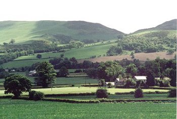
1025 Llanfair Dyffryn Clwyd character area. Large, widely-scattered farms and halls with small areas of parkland set within landscape of generally large rectilinear fields. View across Dyffryn Clwyd with Plas Newydd farm in the middle distance and Moel Llanfair beyond. Photo: CPAT 810.13A (back to map)
|
Click here for further information about this Historic Landscape Character area
Click here for character area map
|

|
|
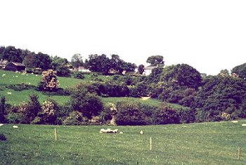
1026 Bachymbyd character area. Scattered farms in landscape of medium-sized irregular fields on western edge of vale, with areas of ancient woodland on steeper slopes and steep-sided stream valleys. View looking north-westwards towards Ty-mawr from Bachymbyd-bâch. Photo CPAT 810.21A (back to map)
|
Click here for further information about this Historic Landscape Character area
Click here for character area map
|

|
|
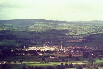
1027 Rhuthun character area. Expanding modern town of Ruthin with evidence of Romano-British activity and origins as medieval castle borough, and late medieval and 17th- to 19th-century buildings.Distant view of Ruthin from the slopes of Foel Fenlli, on the Clwydian hills. Photo CPAT 8091A (back to map)
|
Click here for further information about this Historic Landscape Character area
Click here for character area map
|

|
|
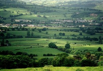
1028 Llanbedr Dyffryn Clwyd character area. Landscape of generally large rectangular fields towards the floor of the valley and along the Dwr Iâl stream. View of the characteristic rectangular fields in the character area, looking eastwards from the east of Rhiw-lâs farm with the outskirts of Ruthin in the background. Photo CPAT 809.4A (back to map)
|
Click here for further information about this Historic Landscape Character area
Click here for character area map
|

|
|
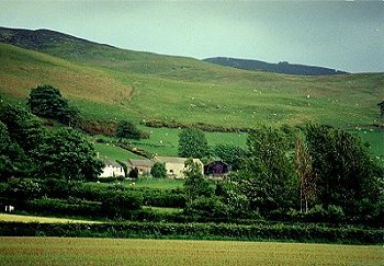
1029 Tyddyn Ucha character area. Landscape of dispersed upland farms and small irregular fields on lower slopes of Clwydian hills, approached by a network of twisting lanes and hollow-ways. Tyddyn Ucha farm from the south, with the Clwydian hills in the distance. Photo CPAT 831.8 (back to map)
|
Click here for further information about this Historic Landscape Character area
Click here for character area map
|

|
|
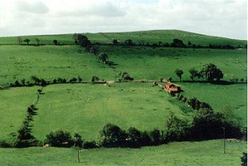
1030 Fron-heulog character area. 19th-century enclosure of upland commons on western slopes of the Clwydian hills with roadside cottage encroachments. Seen here is characteristic 19th-century enclosure of upland common, looking southwards, just to the east of Bwlch-y-llyn farm. Photo CPAT 809.25 (back to map)
|
Click here for further information about this Historic Landscape Character area
Click here for character area map
|

|
|
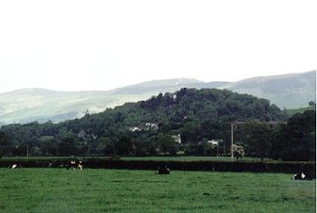
1031 Graig-fechan character area. Deciduous woodland and nucleated roadside settlement with 18th- to 19th-century cottages, chapels and 20th-century housing, set around prominent, isolated limestone hill. Isolated limestone outcrop on the south-eastern side of the vale, with Moel Famau beyond. Photo CPAT 810.8A (back to map)
|
Click here for further information about this Historic Landscape Character area
Click here for character area map
|

|
|
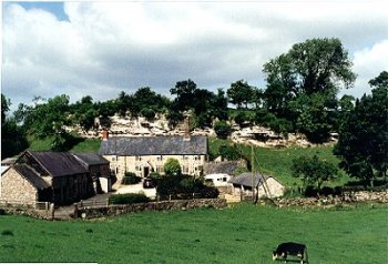
1032 Eyarth character area. Scattered farms and halls on wooded limestone crags on south-western side of vale with linear fields created by gradual clearance of the natural woodland. Seen here is Ty-brith with limestone crags behind, at the southern end of the character area. Photo CPAT 810.5A (back to map)
|
Click here for further information about this Historic Landscape Character area
Click here for character area map
|

|
|
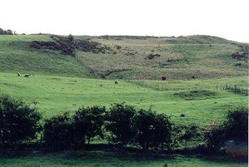
1033 Bryn-isaf character area. 19th-century enclosure of upland commons on western slopes of Clwydian hills with roadside cottage encroachments. Seen here is post and wire fencing, just to the north of Graig farm. Photo CPAT 809.17. (back to map)
|
Click here for further information about this Historic Landscape Character area
Click here for character area map
|

|
|
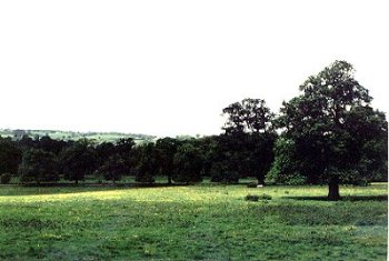
1034 Felin-ysguboriau character area. Large dispersed farms and mills in landscape of medium to large-sized fields of low-lying but well drained pasture between the Afon Clwyd and the Dwr Iâl stream on the southern outskirts of Ruthin. Seen here is low-lying meadow land, just to the south of Ruthin. Photo CPAT 810.20A (back to map)
|
Click here for further information about this Historic Landscape Character area
Click here for character area map
|

|
|
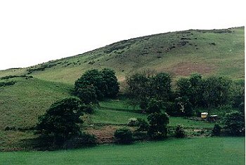
1035 Moel y Parc character area. Unenclosed upland forming part of Clwydian hills towards the northern end of the landscape area. View from the south, with 19th-century encroachment with ruined farm buildings (near caravan) just north of Aifft. Photo CPAT 812.12 (back to map)
|
Click here for further information about this Historic Landscape Character area
Click here for character area map
|

|
|
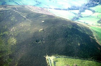
1036 Moel Llanfair character area. Open moorland towards the southern end of the Clwydian hills, comprising parts of Moel Gyw, Moel Llanfair, Moel Llêch, Moel y Plâs, Moel y Gelli, Moel y Waun and Moel yr Accre which extend outside Dyffryn Clwyd, improved pasture on less steep slopes accessed by modern farm tracks. (back to map)
|
Click here for further information about this Historic Landscape Character area
Click here for character area map
|

|
|
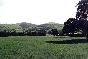
1037 Bathafarn character area. Landscape of large rectangular fields with robust hedges on lower slopes of the Clwydian hills, resulting from enclosure of medieval park during the second half of the 16th century. Photo CPAT 809.8 (back to map)
|
Click here for further information about this Historic Landscape Character area
Click here for character area map
|

|
|
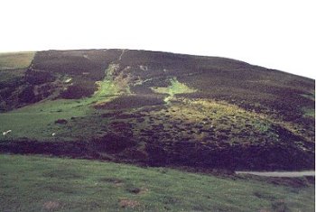
1038 Moel Famau character area. Distinct stretch of open moorland interrupted by minor passes, with the important Iron Age hillforts and the remains of the Victorian Jubliee Tower marking a number of the peaks along the crest of the hills. The character are includes parts of the following named hills: Moel Arthur, Moel Llys-y-coed, Moel Dywyll, Moel Famau, Moel y Gaer, Foel Fenlli, Moel Eithinen, and Gyrn. Seen here is heather moorland on the slopes of Foel Fenlli, the ramparts of the Iron Age hillfort just breaking the skyline. Visitor erosion is a constant problem here, on the steep slopes of the Clwydians. Photo CPAT 809.5 (back to map)
|
Click here for further information about this Historic Landscape Character area
Click here for character area map
|

|
|
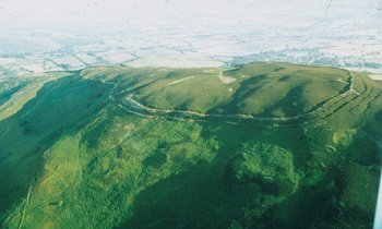
1039 Penycloddiau character area. Distinct stretch of open moorland including the important Iron Age hillfort on the crest of the hills. (back to map)
|
Click here for further information about this Historic Landscape Character area
Click here for character area map
|

|
|
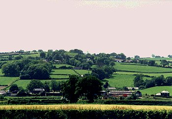
1040 Llanrhaeadr-yng-nghinmeirch character area. Landscape of close-set farms and smallish irregular fields on western slopes of Dyffryn Clwyd, with Pentre Llanrhaeadr in the middle distance. Photo CPAT 811.10A (back to map)
|
Click here for further information about this Historic Landscape Character area
Click here for character area map
|

|
|
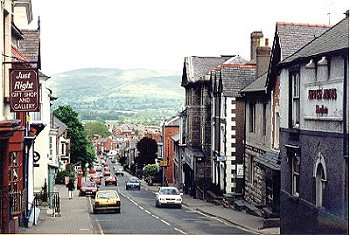
1041 Dinbych character area. Expanding modern town of Denbigh, with origins as a medieval castle borough, and late medieval and 17th- to 19th-century buildings. Looking eastwards down Vale Road, Denbigh, towards Moel y Parc. This is one of the new roads laid out during the 14th-century as the town spread beyond its inconvenient hilltop location further to the west. Photo CPAT 811.21A (back to map)
|
Click here for further information about this Historic Landscape Character area
Click here for character area map
|

|
|
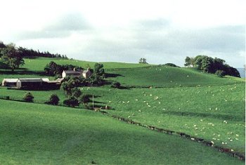
1042 Pen-yr-allt character area. Landscape of small farms on wooded slopes and valleys, just below the moorland edge, seen here looking southwards towards Bwlch-uchaf, below Moel Gyw. Photo CPAT 809.00A (back to map)
|
Click here for further information about this Historic Landscape Character area
Click here for character area map
|

|
|
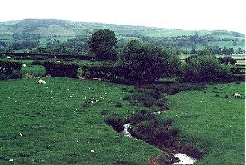
1043 Llandyrnog character area. Part of the landscape of smaller farms and medium-sized rectangular fields with hedged boundaries, sometimes set out in relation to the natural streams running westwards from the Clwydian hills. Photo CPAT 812.22 (back to map)
|
Click here for further information about this Historic Landscape Character area
Click here for character area map
|

|
|
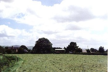
1044 Llanynys character area. Clustered small farms on isolated area of better-drained land at the confluence of the Clywedog and Clwyd rivers. Photo CPAT 811.9A (back to map)
|
Click here for further information about this Historic Landscape Character area
Click here for character area map
|

|
|
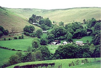
1045 Fron-gelyn character area. Landscape of relatively small irregular fields with hedge boundaries on steep western slopes of the Clwydian hills, seen here looking eastwards towards Ty Newydd, Aifft. Photo CPAT 812.8 (back to map)
|
Click here for further information about this Historic Landscape Character area
Click here for character area map
|

|
|
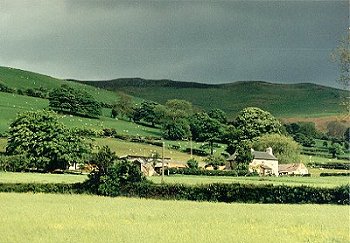
1046 Rhiwbebyll character area, a landscape of small to medium-sized rectangular hedged fields and scattered farms strung out along the spring line, just below the moorland, seen here looking towards Gales-uchaf farm. Photo CPAT 813.00 (back to map)
|
Click here for further information about this Historic Landscape Character area
Click here for character area map
|

|
|
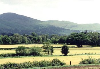
1047 Rhôs character area. Landscape of large drained meadows bounded by drainage dykes and hedges bordering the river Clwyd, seen here just to the east of Llanynys, looking to the south-east. Photo CPAT 811.5A. (back to map)
|
Click here for further information about this Historic Landscape Character area
Click here for character area map
|

|
|
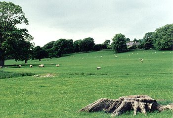
1048 Fron Yw character area. Extensive area of parkland belonging to Vron Yw, a large house rebuilt in 1906 and now used as a nursing home, replacing an earlier building of the mid 17th-century. Parkland, one of the distinctive historic landscape features of Dyffryn Clwyd, can quickly disappear if old trees are felled and not replaced. Photo CPAT 812.23 (back to map)
|
Click here for further information about this Historic Landscape Character area
Click here for character area map
|

|
|

1049 Hirwaen character area. Moorland-edge and lower-lying farms in landscape of smaller rectangular fields set out along the contour. (back to map)
|
Click here for further information about this Historic Landscape Character area
Click here for character area map
|

|
|

1050 Esgairlygain character area. Distinctive landscape of linear strip fields running downhill from the scattered farms lying just below the moorland edge, seen here looking towards Tyn-y-celyn farm with the Jubilee Tower on Moel Famau on the distant horizon. Photo CPAT 813.8 (back to map)
|
Click here for further information about this Historic Landscape Character area
Click here for character area map
|

|
|
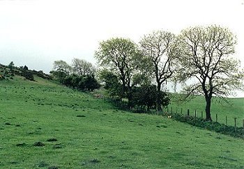
1051 Fron-dyffryn character area. 19th-century enclosure of upland commons, with medium to large-sized rectangular fields enclosing upland rough grazing and some improved pasture, with field boundaries formed of thin and occasionally grown out hawthorn hedges, occasionally represented by intermittent lines of trees and shrubs, being replaced by post and wire fencing. The boundary here is running southwards towards Moel Arthur, and lies on the county boundary. Photo CPAT 813.4 (back to map)
|
Click here for further information about this Historic Landscape Character area
Click here for character area map
|

|
|
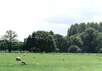
1052 Lleweni character area. Flat, low-lying irregular drained meadows within area of the former late glacial called Lake Clwyd. Photo CPAT 812.0 (back to map)
|
Click here for further information about this Historic Landscape Character area
Click here for character area map
|
|
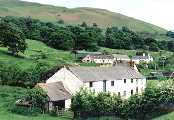
1053 Aberchwiler character area. The former clover mill know as Candy Mill, towards the head of the Aberchwiler valley, with Ty-draw farm and Moel y Parc beyond. Photo CPAT 812.17 (back to map)
|
Click here for further information about this Historic Landscape Character area
Click here for character area map
|

|
|
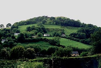
1054 Bodfari character area. Isolated and partly wooded hill rising steeply to the Iron Age hillfort of Moel y Gaer (Bodfari) at the summit, and with small farms and irregularly-shaped pasture fields cut out piecemeal fashion from the woodland. Photo CPAT 812.16 (back to map)
|
Click here for further information about this Historic Landscape Character area
Click here for character area map
|

|
|
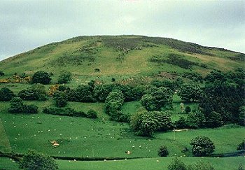
1055 Coed Draw character area, on lower slopes of Moel y Parc, with small to medium-sized fields resulting from piecemeal woodland clearance. In the 1780s Thomas Pennant described 'the lofty mountain Moel y parc, skirted with trees'. Photo CPAT 812.19 (back to map)
|
Click here for further information about this Historic Landscape Character area
Click here for character area map
|

|
|
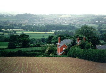
1056 Glan Clwyd character area, a landscape of scattered, medium-sized farms in landscape of medium-sized rectangular and strip fields, viewed looking west towards Denbigh, just to the north of Dhi Coch Ganol (Dre Gch Ganol);Dhi Coch Ganol farm. Photo CPAT 812.7 (back to map)
|
Click here for further information about this Historic Landscape Character area
Click here for character area map
|

|
|

1057 Plâs Ashpool character area. Parkland and land of parkland character and scattered large farms and large houses. (back to map)
|
Click here for further information about this Historic Landscape Character area
Click here for character area map
|

|
|
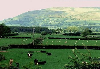
1058 Meusydd-brwyn character area, a distinctive landscape of rectangular and strip fields, drainage dykes and small ponds, with scattered farms and smallholdings, on north-east outskirts of Denbigh, viewed looking north-eastwards, just to the south of Mytton Park. Photo CPAT 812.1 (back to map)
|
Click here for further information about this Historic Landscape Character area
Click here for character area map
|

|
|
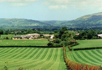
1059 Ystrad character area, a landscape of scattered large farms and large rectangular fields of pasture on sloping ground, overlooking the western side of the vale, just to the south of Denbigh, viewed from the west, withYstrad Farm in the middle distance. Photo CPAT 811.15A (back to map)
|
Click here for further information about this Historic Landscape Character area
Click here for character area map
|

|
|
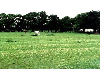
1060 Penpalmant character area, a landscape of irregular, medium-sized hedged fields with scattered larger oaks, ponds and some ridge and furrow, seen here just to the south of Penpalmant farm, the ridge and furrow in this field emphasised by daisies growing on the drier ridges. Photo CPAT 811.22A (back to map)
|
Click here for further information about this Historic Landscape Character area
Click here for character area map
|

|
|
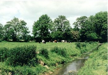
1061 Gwergwy character area. Low-lying meadow land around the confluence of the Afon Clywedog and Afon Clwyd, with drainage dykes, embanked and canalised streams, illustrating the history of water management in Dyffryn Clwyd. Photo CPAT 811.4A (back to map)
|
Click here for further information about this Historic Landscape Character area
Click here for character area map
|
For further information please contact the Clwyd-Powys Archaeological Trust at this address, or link to the Countryside Council for Wales' web site at www.ccw.gov.uk
Privacy and cookies
|


 Ornamental and Picturesque Landscapes


