Cymraeg / English

|
Vale of Clwyd Historic Landscape |

|
Character area map |
Historic Landscape Characterisation
The Vale of Clwyd:
Bathafarn, Llanbedr Dyffryn Clwyd, Llanfair Dyffryn Clwyd, Denbighshire
(HLCA 1037)
Landscape of large rectangular fields based on lower slopes of the Clwydian hills, representing remodelling of medieval park during the second half of the 16th century.
Historic background
The area covers parts of the ancient ecclesiastical parishes of Llanfair, Llanrhudd and Llanbedr in the medieval commotes of Llannerch and Dogfeilyn, on the eastern side of the cantref of Dyffryn Clwyd, which became the lordship of Ruthin held by the de Greys after the Edwardian conquest of Wales. The character area covers the lower part of Bathafarn Park, a hunting park held by the de Greys which had was probably established soon after the creation of the lordship of Ruthin in the later 13th century, if not earlier. It is estimated that the entire park, parts of which fall within character areas to the east, covered about 400 hectares The boundaries of the park were defined by a bank and ditch known as Clawdd y Park, the course of which is represented by a present-day ditch which is taken to define part of the western boundary of the character area. One of the two main park gates was near Plâs-yn-rhal. The park was sold to the Thelwalls before 1592, considerable improvements and changes to the landscape of this lower part of the park being made in the period between 1553 and 1592, when the first hall was erected, and it was probably during this period that the present-day field system was laid out. Prior to this it is said that the park included a number of tenements, including about thirty acres of arable and meadow laid out in quillets. Contemporary records indicate that arable and meadow, probably all in this lower part of the park, was created by rooting up trees, draining marshy ground by digging ditches and dividing the cleared area into fields by quickset hedges
Key historic landscape characteristics
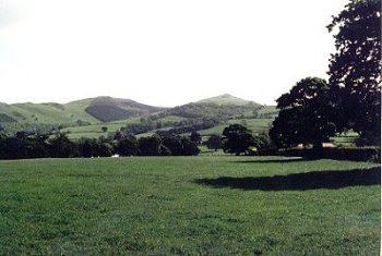
Lower, west-facing, slopes of the Clwydian hills, at a height of between about 80-160m.
Bathafarn Hall appears to have been first established during the Elizabethan period, though the present building, with a stand of trees to the east, is 19th-century stucco with brick stable block. Bathafarn Farm has an 18th-century brick farmhouse and stone outbuildings replaced by a modern brick farmhouse and modern outbuildings.
Distinctive landscape of relatively large rectangular fields set out around Bathafarn Hall, Bathafarn Farm and Bacheirig farm on lower slopes of the Clwydian hills, the fields bounded by robust hawthorn hedges and drainage ditches. Some drystone walling near entrance to Bathafarn Farm. The boundaries of the character area have been extended beyond the presumed western and southern limits of the medieval park to encompass other fields which appear to be broadly contemporary with the subdivision of the former park.
Bathafarn Hall is enclosed by former parkland and approached by means of 19th-century gates and lodge on main road. Field boundaries between the hall and Bathafarn Farm were deliberately curved to enhance the visual effect of the parkland. The grounds are described by Thomas Pennant (1793, 65): 'The grounds rise with rich cultivation from the house, and are delightfully varied with hanging woods'.
Sources
Berry 1994Richards 1969
For further information please contact the Clwyd-Powys Archaeological Trust at this address, or link to the Countryside Council for Wales' web site at www.ccw.gov.uk.
Privacy and cookies