Cymraeg / English

|
Vale of Clwyd Historic Landscape |

|
Character area map |
Historic Landscape Characterisation
The Vale of Clwyd:
Bachymbyd, Llanynys and Ruthin, Denbighshire
(HLCA 1026)
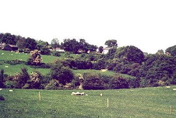
Scattered farms in landscape of medium-sized irregular fields on western edge of vale, with areas of ancient woodland on steeper slopes and steep-sided stream valleys.

Historic background
Falling along the western side of the medieval ecclesiastical parish of Llanynys, and administratively along the eastern edge of the commote of Ceinmeirch, in the ancient cantref of Rhufoniog.
Key historic landscape characteristics
Steeply sloping western edge of the vale, rising from a height of about 50m OD, just above the floor of the valley, to a height of over 150m OD within the historic landscape area and more beyond it. Some flatter ground towards the valley floor and on the hill tops. The valley side is broken by several steep-sided gorge-like valleys including the Nant Gôch at the northern end of the area and the dramatic valley of the Clywedog to the west of Rhewl.
Farms generally widely scattered farms and set above the valley floor, either on the lower hill slope or on the slightly flatter ground towards the hilltops to the west, with a scattering of 20th-century houses on the main road between Ruthin and Rhewl. The earliest buildings are represented by parts of a late medieval barn with two crucks and some timber-framed walling at Bachymbyd Fawr and timber-framed buildings at Rhyd-y-cilgwyn. Large remodelled 17th-century brick-built house belonging to the Salusburys also at Bachymbyd Fawr. Buildings at the remaining farms are largely of 18th- and 19th-century date, including the brick farmhouse and limestone outbuildings and stone-walled yard at Bachymbyd-bâch farm and the large rendered farmhouse and stone outbuildings and stone-walled yard at Ty-mawr. Whitewashed stone farmhouse at Berth, with stone outbuildings and stone-walled yard, both incorporating megalithic elements in their construction. Scattered smaller 18th/19th-century limestone farmhouses and outbuilding on the higher ground in southern part of area, such as Pen-y-bryn, Ty'n-y-caeau and Pen-y-graig, some linked by green lanes. Some older farmsteads have been abandoned and are now represented by banks and platforms.
Irregular, medium-sized fields bounded by hazel, hawthorn, holly and oak hedges, predominantly improved pasture, with larger fields occasionally subdivided by post and wire fences and lynchets on steeper slopes. Slight and occasionally wandering banks and hedges suggesting that some fields were created by assarting from the natural woodland. Some banks include rounded glacial boulders, up to 1m across, and possibly partly created by stone clearance, some field banks being revetted with rough walling near gateways to prevent erosion by stock. Some hedges well maintained and occasionally laid, others grown-out and supplemented by post and wire or now only represented by an intermittent line of more mature trees. Several small ponds of uncertain origin in the vicinity of Ty'n-y-caeau. Stone gateposts for farm entrances and fields both on and off the public roads.
Mixed deciduous woodland of oak and ash, together with alder, gorse, ash, hazel and holly on steeper steep-sided stream valleys, and on steeper slopes elsewhere, together with a number of small conifer plantations, the deciduous woodland in Coed Ystig in Nant Gôch, Coed Orllwyn to the west of Rhewl, and Coed Ty'n-llwyn and Coed Graig-y-fferm being classed as ancient semi-natural woodland.
Irregular lanes running in steep-sided hollow-ways on the steeper slopes, occasionally revetted in stone, often bounded by holly hedges.
Former mill and cottages along the fast flowing Afon Clywedog to the west of Rhewl. Large disused limestone quarry and limekiln at Craig-y-ddywart, to the north-west of Ruthin.
The area includes the 17th-century walled garden with bee boles at Bachymbyd, listed in Register of Landscapes, Parks and Gardens, and Lady Bagot's Drive, a former Edwardian carriage drive along the north bank of the wooded Clywedog gorge, now a footpath.
Sources
Hubbard 1986Walker & Richardson 1989
For further information please contact the Clwyd-Powys Archaeological Trust at this address, or link to the Countryside Council for Wales' web site at www.ccw.gov.uk.
Privacy and cookies