Cymraeg / English

|
Introduction |

|
Interactive map |

|
Surrounding area |

|
History of the town |

|
Index of sites |

Your Community - Welshpool
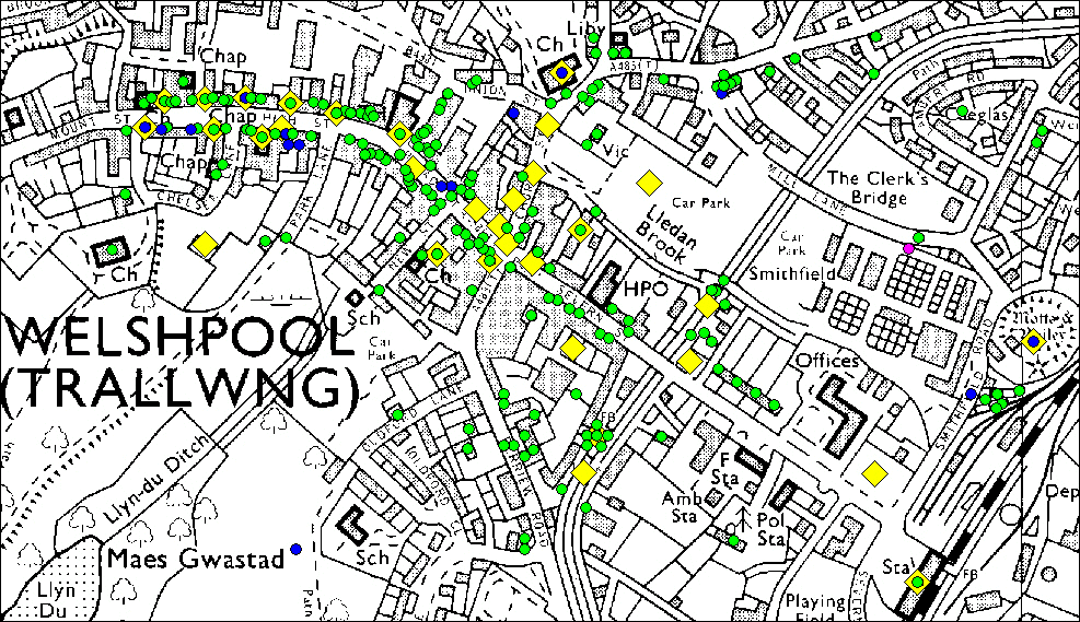
As part of our Regional Heritage Management Service funded by Cadw, and in conjunction with the Welshpool Partnership and the BBC Walk Through Time web pages for mid-Wales (linked to the TV series British Isles, A Natural History), the Clwyd-Powys Archaeological Trust have created an interactive map of Welshpool, Powys and various supporting web pages about the town and its surroundings. Visitors can interrogate the map and read about, and see photographs of, the sites, monuments, buildings and artefacts of archaeological and historical interest, and access background information. This information comes from the Regional Historic Environment Record (HER), a public-access database about archaeology and history curated by CPAT.
Please remember that while many of the sites discussed here are visible from public roads and footpaths most of them are private property, and this should be respected.
The Green spots represent Post Medieval sites, the blue ones Medieval sites and the solitary purple one is Roman. The yellow diamonds lead to a selection of photographs.
|
|
Map a atgynhyrchwyd o fap yr OS gyda chaniatad yr Arolwg Ordnans ar ran Rheolwr Llyfrfa Ei Mawrhydi, © Hawlfraint y Goron 2004.
Cedwir pob hawl. Byddai ei atgynhyrchu heb ganiatad yn torri Hawlfraint y Goron a gall hynny arwain at erlyniad neu achos sifil. Rhif y drwydded: GD272221
Base map reproduced from the OS map with the permission of Ordnance Survey on behalf of The Controller of Her Majesty's Stationery Office, © Crown Copyright 2004.
All rights reserved. Unauthorised reproduction infringes Crown Copyright and may lead to prosecution or civil proceedings. Licence Number: GD272221
Privacy and cookies
