Cymraeg / English

|
Introduction |

|
Interactive map |

|
History of the settlement |

|
Index of sites |

Your Community - Frith
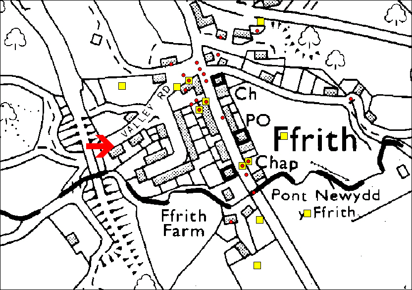
As part of our Regional Heritage Management Service funded by Cadw, and in conjunction with Time Team, the Clwyd-Powys Archaeological Trust have created an interactive map of Ffrith, Flintshire and a supporting web page about the settlement. Visitors can interrogate the map and read about the sites of archaeological and historical interest, and access background information. This information comes from the Regional Historic Environment Record (HER), a public-access database about archaeology and history curated by CPAT.
Please remember that while many of the sites discussed here are visible from public roads and footpaths most of them are private property, and this should be respected.
Click on a coloured point of interest to access, and if you wish print out, the information behind it from the HER. The red circles represent records of archaeological and historical sites, the yellow squares records of past archaeological investigations.
|
|
Map a atgynhyrchwyd o fap yr OS gyda chaniatad yr Arolwg Ordnans ar ran Rheolwr Llyfrfa Ei Mawrhydi, © Hawlfraint y Goron 2005.
Cedwir pob hawl. Byddai ei atgynhyrchu heb ganiatad yn torri Hawlfraint y Goron a gall hynny arwain at erlyniad neu achos sifil. Rhif y drwydded: GD272221
Base map reproduced from the OS map with the permission of Ordnance Survey on behalf of The Controller of Her Majesty's Stationery Office, © Crown Copyright 2005.
All rights reserved. Unauthorised reproduction infringes Crown Copyright and may lead to prosecution or civil proceedings. Licence Number: GD272221
Privacy and cookies
