Cymraeg / English

|
Introduction |

|
Interactive map |
|
|
History of the settlement |
|
|
Index of sites |
Your Community - Ffrith
As part of our Regional Heritage Management Service funded by Cadw, and in conjunction with Time Team, the Clwyd-Powys Archaeological Trust have created an interactive map of Ffrith, Flintshire and a supporting web page about the settlement. Visitors can interrogate the map and read about the sites of archaeological and historical interest, and access background information. This information comes from the Regional Historic Environment Record (HER), a public-access database about archaeology and history curated by CPAT.
Please remember that while many of the sites discussed here are visible from public roads and footpaths most of them are private property, and this should be respected.
A brief history of Ffrith . . .
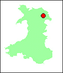
Location
Ffrith occupies the valley floor where Nant y Ffrith converges on the River Cegidog. To the north-east the bulk of Hope Mountain rises sharply, but opposite the settlement the valley sides are more gentle.
Ffrith lies a short distance from Llanfynydd on the B5101 and 7km north-west of Wrexham.
History
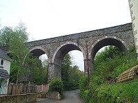
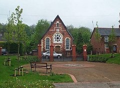
Intensively used in the Roman period, and traversed by Offa's Dyke several centuries later, Ffrith otherwise seems to have emerged as a settlement only in the 19th century. The church is no earlier than 1842/3 and the Tithe Map of 1850 shows perhaps half a dozen houses, all on the south side of the River Cegidog and north of Valley Road. Later, an industrial element emerged on the north side of the Cegidog including a smithy (103867) and lime kilns ( 72491, 103886, 103868, 103863, 103868, 103866, 103887, 41437). During the latter nineteenth century Ffrith was served by a halt on the Wrexham & Minera Branch of the Great Western Railway, which also fed various links to the surrounding collieries, limeworks and the Cae Llo brick works to the south of the village.
Modern housing spreads over the valley floor, between Valley Road and Nant y Ffrith, but with little expansion on the south side of the stream.
Buildings and Archaeology
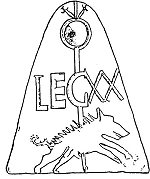
A substantial Roman site (100020) underlies the later village. The settlement, on the roman road (86912) from Chester to Caer Gai, was first recorded by Camden in the late 16th century (100021). It appears to have been a civilian community, although the number of tiles (100025, 100026) attributable to the XXth Legion implies a military connection.
Offa's Dyke (88735, 34972, 17399) is visible as an earthwork to the north of Ffrith. Within the village it has been levelled, and its course followed by the B5101.
A mid-18th century packhorse bridge (100035) spans the River Cegidog on the eastern perimeter of the settlement with a paved ford just downstream.