Cymraeg / English

|
Tanat Valley Historic Landscape |

|
Character area map |
Historic Landscape Characterisation
The Tanat Valley:
Maesmochnant, Llanrhaeadr-ym-mochnant, Powys
(HLCA 1002)
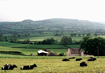
Large rectangular fields with hedge boundaries on flat terrace slightly raised above the valley bottom, with complex of cropmark prehistoric and funerary monuments and standing stone.

Historic background
The character area falls within the medieval ecclesiastical parish of Llanrhaeadr-ym-mochnant, and falls within the ancient commote of Mochnant Is Rhaeadr, Denbighshire.
Probable late Neolithic and early Bronze Age activity in the character area is represented by a probable henge monument and two timber circles and the large Maesmochnant standing stone, which represent an important prehistoric ritual complex in the area between Meusydd and Maesmochnant-uchaf. The complex also includes a number of ring-ditches which probably represent ploughed-down burial mounds. A large mound just to the east of the Maesmochnant standing stone, near the edge of the terrace, appears to represent a large burial mound which has partly survived ploughing. Also in the Meusydd area, to the north-west, coincidentally to the west of the modern cemetery, aerial photography has also revealed a cemetery of no less than about 40 inhumation graves aligned approximately east-west. The historic context for this cemetery is uncertain, given that the church at Llanrhaeadr-ym-mochnant appears to have been founded by at least the ninth century, but a date in the early medieval period seems most likely. A number of other cropmarks are known in the area which appear to indicate a pattern of enclosures or field boundaries pre-dating the present field pattern, although their date is uncertain.
Key historic landscape characteristics
Flat and gently undulating flat terrace slightly raised above the valley bottom, between about 120-50m OD. The area is largely well-drained and underlain by gravel with numerous braided palaeochannels of probable late glacial or early post-glacial date visible as cropmarks on aerial photographs.
Present-day settlement in the area principally limited to the two farms of Maesmochnant-uchaf and Maesmochnant-isaf, just under 1km apart. Maesmochnant-uchaf has an 18th-century stone farmhouse with 18th/19th-century stone outbuildings and 20th-century brick outbuildings. The stone buildings are of rounded boulders, probably from field clearance and river-beds, with brick and ashlar dressings. Ty'n-y-maes has a 19th-century stone farmhouse and outbuildings, some of brick. The modern housing at Meusydd lies just outside the character area.
Large rectangular fields bounded by generally low-cut mature mixed-species hedges including hawthorn, hazel, ash. Scattered mature oaks in field boundaries and taller alder trees on the banks of the Afon Iwrch and Afon Rhaeadr. It seems probable that during the early medieval and medieval period the area included the open arable field or town fields belonging to the small market town of Llanrhaeadr-ym-mochnant which lies about 1km to the north-west. A number of fields have 'maes' names, indicative of open arable, as well as the three farms on the margins of the area - Ty'n-y-maes, Maesmochnant-isaf and Maesmochnant-uchaf. The fairly regular present-day field pattern therefore appears to represent 18th-century enclosure of the former medieval town fields.
Some squared stone gateposts to field entrances on the main road.
The major road junction where the Llangedwyn to Llanrhaeadr-ym-mochnant splits off from that which goes on to Llangynog lies at the heart of the area. These main roads are late 18th-century turnpike roads; they are slightly raised above the level of the surrounding fields and cut across a number of earlier field boundaries. The other minor roads in the area run in slight hollow-ways. The area is crossed by the line of the Tanat Valley Light Railway the course of which is visible in places, some areas of which are now have invasive trees and shrubs. The station yard of the former 'Llanrhaiadr Mochnant' station, to the north of Maemochnant-uchaf, is still partly used as a storage depot.
By tradition the Maes Mochnant standing stone was raised in order to stop the devastation being caused in the surrounding country by a dragon or serpent - the beast eventually being killed by dashing itself against the stone.
Sources
Britnell 1991Hancock 1871
Sayce 1930
St Joseph 1979
Richards 1934b
Wren 1968
For further information please contact the Clwyd-Powys Archaeological Trust at this address, or link to the Countryside Council for Wales' web site at www.ccw.gov.uk.
Privacy and cookies