Cymraeg / English

|
The Middle Wye Historic Landscape |

|
Character area map |
Historic Landscape Characterisation
The Middle Wye:
Ffostyll
Gwernyfed and Talgarth, Powys
(HLCA 1093)
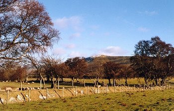
Small, isolated church settlement at Llanelieu surrounded by lower hill land at the foot of the Black Mountains with dispersed farmsteads in a landscape of wooded slopes and large polygonal fields perhaps first enclosed early post-medieval period.

Historic background
Early prehistoric activity is represented by an adjacent pair of Neolithic long cairns at Ffostyll, together with several former Bronze Age round barrows and a possible stone circle no longer visible above ground, and a possible recently identified barrow. Prehistoric settlement is suggested by several flintwork scatters, notably in the vicinity of the Ffostyll long cairns. The fabric of the church dedicated to St Ellyw at Llanelieu dates to about the 13th century though it lies within a large circular churchyard and is associated with two cross-incised stones of 7th- to 9th-century date, suggesting that the church formed part of a pre-conquest nucleated bond settlement. Following the Norman conquest the area formed part of the sub-lordship of Talgarth and after the Act of Union in 1536 it fell within the hundred of Talgarth . In the mid 19th century the area formed part of the tithe parishes of Bronllys, Glasbury, Llanelieu, and Talgarth.
Key historic landscape characteristics
The area occupies predominantly facing north-west lower hill land, between a height of 150-350m above Ordnance Datum. The soils are mostly well-drained fine reddish loams (Milford Series), overlying sandstone. The present-day land-use is largely pastoral, with areas of remnant ancient semi-natural broad-leaved woodland surviving on steeper slopes at Park Wood and Bradwys.
The small nucleated church settlement of Llanelieu, at the head of the steep-sided valley of Cwm Rhyd-Ellywe, includes a cluster of stone-built farm complexes including Llanelieu Court and Ty-du. These probably originated from the amalgamation of smaller holdings in the later medieval period, though the farmhouse at Llanelieu Court has two arched doorways which possibly survive from a 14th-century monastic cell of Llanthony Priory based at Llanelieu. Settlement in the surrounding countryside is predominantly represented by medium to large-sized farms of 18th-century origin, generally associated with springs or streams, and characteristically, as at Ffostyll, originally with stone farmhouses and outbuildings.
The agricultural landscape is characterized by a series of large polygonal fields, just below the unenclosed Common Land of Rhos Fach Common and Rhos Fawr Common, generally defined by low-cut multi-species hedges, with large banks revetted with drystone or orthostatic walling defining the margins of the common. There are recent stone clearance banks along some roadside verges.
Many of the twisting lanes, hollow-ways and footpaths cross the area are probably of considerable antiquity, linking the lowland farms in the valley of the Llynfi below, with the upland pastures of the Black Mountains above and running through distinct hollow-ways up to 3m deep on steeply sloping ground. On the flatter, higher ground the lanes are straighter and were probably only formalised when the land was first enclosed.
Former industry in the area is represented by former limekilns of probable post-medieval date recorded in Park Wood and to the north of Gwernllwyd Farm. Other limekilns north of Cwm Pwll-y-wrach and to the south-west of Llanelieu are suggested by the field-names Cae rodin and Cae y roden from Cae'r odyn ('kiln field') recorded as field-names in the mid 19th-century Tithe schedule.
Sources
Bevan & Sothern 1991;
Cadw 1995a;
Cadw 1995c;
Haslam 1976;
Jenkinson 1997;
Jones & Smith 1964;
Powys Sites and Monuments Record;
Silvester 1999a;
Silvester & Dorling 1993;
Soil Survey 1983;
Williams 1976
For further information please contact the Clwyd-Powys Archaeological Trust at this address, or link to the Countryside Council for Wales' web site at www.ccw.gov.uk.
Privacy and cookies