Cymraeg / English

|
Maelor Saesneg Historic Landscape |

|
Character area map |
Historic Landscape Characterisation
Maelor Saesneg:
Iscoyd
Bronington and Willington Worthenbury communities, Wrexham County Borough
(HLCA 1127)
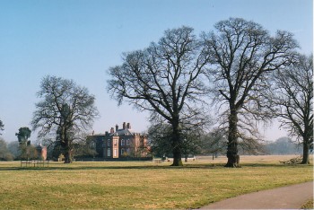
 Rural landscape with traces of ancient woodland and medieval open fields, with dispersed farms and Iscoyd Park country house and landscape park of earlier 18th-century origin.
Historic background
Early prehistoric settlement and land-use in the area is indicated by the probable Bronze Age burial mound known as Warren Tump to the west of Iscoyd Park and by the Bronze Age bronze axe found in the grounds of Iscoyd Park in the mid 19th century. There is no certain place-name evidence for Anglo-Saxon settlement within the area though it has been considered likely that the 'missing' manor of Burwardestone, which is named in the Domesday survey of 1086 probably fell within the area of Iscoyd. The manor had been formerly held by Edwin, the Saxon earl of Mercia, and although it is described as being 'waste' at the time of the Norman conquest in 1066, it seems likely that a well developed agricultural community had already been established in the area by that date. Tenants of the manor in 1086 included two knights (miles) who probably held land in return for military service, emphasising the strategic significance of Maelor Saesneg at that period. Apart from the mention of sufficient arable land for 14 ploughs, the Domesday survey also notes the existence of a salthouse (salina), exploiting the Triassic salt beds exposed by the Wych Brook. The name of the brook and the local place-names in including Upper and Lower Wych include the Old English element wic which commonly refers to salt workings. The workings, though on a much smaller scale than those at early salt-production centres in Cheshire, appear to have continued in existence until the late 18th or early 19th century. Though little documentary evidence appears to have survived it seems likely that a medieval manorial centre became established at the moated site at Wolvesacre Hall perhaps as early as the late 13th century, preceding the existing post-medieval house. A second moated site may have existed just opposite Maes-y-groes Farm. A substantial medieval house is also said to have existed on the site of Iscoyd Park, possibly on the site of an earlier park. The present house, landscape park and pleasure garden have their origin in the earlier 18th-century when it formed an estate belonging to a branch of the Hanmer family, which passed through various other hands during the course of the 19th century, the parkland being requisitioned for a military hospital during the Second World War. Whitewell Lodge, a large 19th-century brick-built hunting lodge in the southern corner of the character area, appears to have been associated with Iscoyd Park.Key historic landscape characteristics
The area forms part of the northern edge of Maelor Saesneg running along and sloping down to the Wych Brook or Red Brook which forms the boundary with Cheshire. It generally falls between 30-90 metres above Ordnance Datum and is broken by valleys of several streams such as Iscoyd Brook and Shoothill Brook, tributaries of the Wych Brook, which are often edged by ancient or replanted broadleaved woodland or by small conifer plantations. Modern land use is a mixture of improved pasture and with some arable, mostly for fodder crops. Field boundaries are mostly mixed-species hedges, some including an abundance of holly, with scattered mature oak trees in hedges and former hedge lines.Fieldscapes include a mixture of large and small irregular fields, often on the more broken ground along watercourses, together with an area of strip fields and apparently reorganised strip fields together with a little surviving ridge and furrow to the north and west of Wolvesacre Hall, which appear to derive from the enclosure medieval open fields. A number of place-names in the area, such as Maes-y-groes and Crossfield, may also have their origin in medieval open fields. The former existence of areas of medieval common grazing is suggested by the survival 'green' place-names, including Kil or Kiln Green, Hall Green and Mannings Green, though evidently none of these were the focus of significant encroachment settlements characteristic of some other areas of Maelor Saesneg.
Present-day settlement is represented by scattered farms, the country house complexes at Iscoyd Park and Whitewell, Many of the farmhouses, such as Maes-y-groes and Pen-y-bryn are brick buildings of late 17th-century to 18th-century in date, though an earlier building horizon is represented at The Gelli which originated as a reasonably substantial two-storey timber-framed house of the 17th century. A pair of semi-detached mid 19th-century cottages at Mannings Green, with elaborately decorated ornamental brick chimneys, are characteristic of the estate cottages of the period, presumably built for the Iscoyd Park estate.
A series of corn watermills became established along the Wych Brook including Dymock's Mill, Wych Mill, Llethr Mill and Wolvesacre Mill from the later 18th century onwards, some of which may have earlier origins, whose remains include leats and millponds in addition to the surviving structural evidence.
Sources
Cadw 1995Davies 1949
Hubbard 1986
Pennant 1784
Pratt 1964
Pratt & Pratt 2000
Sawyer & Hacker 1981
Silvester et al. 1992
Spurgeon 1991
Listed Buildings lists
Regional Sites and Monuments Record
For further information please contact the Clwyd-Powys Archaeological Trust at this address, or link to the Countryside Council for Wales' web site at www.ccw.gov.uk.
Privacy and cookies