Cymraeg / English

|
Maelor Saesneg Historic Landscape |

|
Character area map |
Historic Landscape Characterisation
Maelor Saesneg:
Overton
Overton community, Wrexham County Borough
(HLCA 1118)
 Planted medieval borough, possibly superseding early medieval farming settlement, which became a fashionable small market town in the 18th and 19th centuries and continued as the administrative centre for the locality until local government reorganisation until 1974
Historic background
Place-name evidence suggests that Overton may have originated as a Saxon agricultural settlement in perhaps the 8th or 9th century, the name being derived from the Old English place-name elements ofer tun meaning 'tun on the bank'. The name is first recorded with reference to an important Welsh manorial centre held by Madog ap Meredudd, ruler of Powys, in about 1138, subsequently forming part of the estate of Gruffudd Maelor, the Welsh ruler of northern Powys by the early 13th century, possibly focused on a former castle on the bank of the River Dee in the Asney area, 2km away from the town. The status of an earlier settlement at Overton is uncertain, but a market was established here in 1279 and in 1292 it acquired borough status by means of a royal charter, by which time the town's population included fifty-six taxpayers, many of whom are likely to have been English settlers. The town continued to prosper during the 13th and 14th centuries and by the early 14th century its population included a number of relatively affluent Welsh families. The town was evidently badly damaged during the Glyndŵr revolt in 1403, and though it may have taken many years to recover it became the administrative centre for the hundred of Maelor Saesneg in the county of Flintshire at the Act of Union in 1536. By the 18th century the town had re-emerged as a relatively prosperous settlement, though by the early 19th century the market had been discontinued and with little trade and manufacturing being undertaken within it.
Key historic landscape characteristics
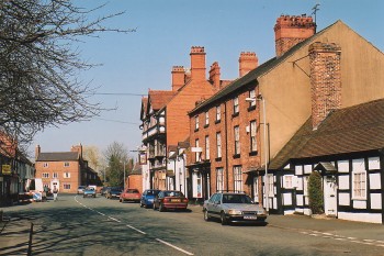
The town lies on flat ground close to an old river scarp above the Dee, and generally lies between 50-60 metres above Ordnance Datum. The older core of the settlement has grid-like pattern of streets of medieval original which developed around the medieval marketplace occupying the broader part of High Street, to the north of the church. Little structural evidence of medieval date has survived above ground apart from St Mary's Church, extensively rebuilt in the 18th and 19th centuries. An earlier building horizon of the 16th and 17th centuries is represented by a small half-timbered cottage near the churchyard, by the front elevation of Quinta Cottage, and by traces of timber-framing visible in the rear elevations of a terrace of houses rebuilt in brick in the 18th century in the High Street. Many of the older buildings in the settlement are of 18th- and early 19th-century date, many of which are painted, including larger detached houses such as Gwydyr House (variously a public house, private residence and shop), Pen-y-llan House (a former malthouse and shop), and terraced houses and cottages, including a number of buildings of a picturesque character, such as The Quinta, with its oriel window, ornate bargeboards and arched windows. In addition to the more substantial middle-class houses, by the end of the 19th century the settlement also included estate workers' cottages, church school, shops, almshouses, cocoa rooms, estate office for the Bryn-y-Pys estate, Methodist chapel, malthouse, rectory, and cemetery chapel. Its importance as a local centre into the early 20th century is further reflected by the former council offices of and the Roman Catholic Church of Our Lady of the Welsh Martyrs both built in the 1950sSources
Done & Williams 1992Fryde 1970-71
Lewis 1833
Gresham 1968
Howson 1883
Hubbard 1986
Pennant 1784
Silvester et al. 1992
Soulsby 1983
Sylvester 1969
Tucker 1958
Listed Building lists
Regional Sites and Monuments Record
For further information please contact the Clwyd-Powys Archaeological Trust at this address, or link to the Countryside Council for Wales' web site at www.ccw.gov.uk.
Privacy and cookies