Cymraeg / English

|
Bro Trefldwyn Historic Landscape |

|
Character area map |
Historic Landscape Characterisation
Bro Trefaldwyn:
Fflos
Forden and Montgomery, Powys and Chirbury, Shropshire
(HLCA 1066)
Late enclosed common pasture in flat valley land along the lower Camlad valley, at the western end of an ancient routeway between the Shropshire plain and mid Wales which crossed the Severn at the historic ford known as Rhydwhiman.
Historic background
The earliest recorded activity in the landscape area appears to be represented by several cropmark ring-ditches, to the north of The Gaer and to the north of Rhydwhyman Farm, suggesting Bronze Age round barrows. The large auxiliary Roman fort known at The Gaer was founded in the 70s or 80s AD on a slight rise above the east bank of the Severn near its confluence with the Camlad, between the legionary fort at Wroxeter and the similarly sized fort at Caersws, towards the head of the Severn valley. The fort is strategically sited on the line of an ancient routeway between the Shropshire plain and mid Wales along the Camlad - Rea valley running through the character area, via Marton, the course taken by the Roman road system linking mid Wales with the rest of the Roman province. The earliest known road taking this route is the Roman road between Wroxeter and Caersws follows this valley, parts of which are still visible near Gunley Hall, just to the east of the character area. The Roman road appears to be followed by the course of the modern road (B4386), along slightly elevated ground along the northern side of the character area, past Rhyd-y-groes and Lower Hem, then striking off across lower ground towards the north gate of the Roman fort at The Gaer. The course of the road deviates to the east, just to the south of the fort suggests that the road was planned to avoid the river bend rather than cross it at this point, and implying that the river meander has moved up to about 100m to the east since Roman times. The Roman road has largely been ploughed down where it crosses agricultural land to north and south of the fort (an east-west road being unknown), but its course is partly known from cropmarks, and is also traceable as a low embankment beneath the railway embankment where it runs towards the river Camlad.The siting of the Roman fort probably owes its existence to an earlier routeway into mid Wales focused on an important and more ancient fording point across the Severn , possibly marked by the standing stone known as the Hoare Stone, just to the east of the Roman fort. The ford no doubt gave rise to the remarkable sequence of defensive structures on the eastern bank of the river in the area of Montgomery including Ffridd Faldwyn Iron Age hillfort, the Roman fort at the Gaer, Hen Domen motte and bailey castle, and Montgomery Castle.
Occupation of the Roman fort continued on one scale or another until sometime in the second half of the 4th century, following a period of refurbishment. A civilian settlement or vicus had developed along the main road leading to the west, on the flatter ground towards the ford on the southern side of the fort. Little is known of the settlement but it probably became established to serve the needs of the military some time during the late 1st century, and appears to have survived until at least the early 3rd century, when it may have ceased to remain viable due to reductions in the size of the garrison. Industries undertaken within the settlement included ironworking A settlement here is probably to be identified with the name Lavobrinta recorded in the Ravenna Cosmography, a 7th-century manuscript based on earlier sources, its name possibly based on a river name, presumably with reference to the Severn, meaning the 'smooth gushing one'. The Anglo-Saxon place-name attached to the fort is the English Tornebury, given in the Doomesday Book of 1086, surviving in the modern area name of Thornbury. The name implies that the fort was at one time covered in scrub vegetation, the land at both Tornebury and Horseforde having been 'waste' at the time of the Norman Conquest in 1066 but noted as being back in production by the time the Domesday Book was compiled in 1086.
A number of cropmark ditched enclosure sites recorded by aerial photography, are known just to the north and north-east of the fort, which probably represent native farmsteads of Roman date focused on the fort. One of the enclosures about 100m to the north of the fort was subsequently overlain by a major post-Roman, aisled timber hall, partly known from excavation. The form of construction and size of the hall have analogies in the early medieval period, and particularly with later Saxon royal palace sites of the 9th to 11th centuries. Regrettably, little more is known of the dating of this important structure, lying 2 kilometres to the west of the late 8th-century Mercian frontier on Offa's Dyke and 5 kilometres to the west of the supposed early 10th-century Mercian burh at Chirbury. A possible historical context for the building might be in AD 822/3 when according to the Brut y Tywysogyon 'the Saxons . . . took the kingdom of Powys for their own', though these gains may have been short-lived.
Resources provided by the Camlad were evidently of importance in the past. The Domesday Book of 1086 records that Hem possessed 3 fisheries, which were presumably sited on the Camlad and may have comprised fish-traps of one form or another. Water-power may also have been exploited. The precise location of the royal mill recorded at Stalloe in the 13th century is unknown, but may have been a watermill on the Camlad.
The place-name Ffl�s, as it appears on modern editions of the Ordnance Survey, has been applied more particularly to the common meadow lands of the town of Montgomery. The name is first recorded in the 14th century and derives from Middle English flosh, 'marshy ground'. Much of the area formed lowland common meadow and pasture belonging to the parishes of Montgomery, Forden and Chirbury probably remained unenclosed until towards the beginning of the 19th century. Between the late 16th century though to the 17th and 18th centuries numerous cases were brought against people encroaching on the common or attempting to enclose parts of it. Partly because of these continuing difficulties and partly due to a desire for improvement of the quality of the pasture, substantial parts of the area were enclosed in the late 18th and early 19th centuries. Parts of the area in the parish of Montgomery were enclosed as part of the Powis Castle estates in the 1780s, in exchange for other land granted to the burgesses of Montgomery. Substantial parts of the area in the parish of Forden, to the north of the Camlad, to the west of Caemwgal and between Caemwgal and Hem Moor, were subject to enclosure awards in 1803.
Key historic landscape characteristics
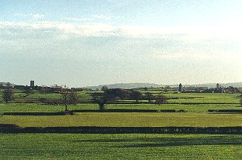
The area is generally flat and low-lying and forms a zone running east-west along the lower Camlad, towards its confluence with the river Severn, and lying between a height of about 80-90m above Ordnance Datum. Some of the land is poorly drained and liable to flooding. Deep, stoneless, alluvial gley soils, clayey in some areas, and in places affected by groundwater. Several ?natural ponds on low-lying ground, including possibly Devil's Hole, east of Caemwgal. The Camlad has numerous meanders where it runs across this low-lying area with steep, actively eroding river cliffs in places to the east of Caemwgal. A number of oxbows are evident, some of which appear to have been infilled since being mapped by the Ordnance Survey in the 1880s, and which may preserve buried palaeoenvironmental deposits. There is also a distinct river terrace to the south-west of the Gaer.Because of the low-lying nature of the ground there is little ancient settlement within the character area, modern settlement being largely confined to Caemwgal farm, a ?19th-century brick-built farmhouse with 20th-century steel-framed outbuildings, Woodmore, with an early to mid 19th-century farmhouse of random stone, and Pound House, an early to mid 19th-century stone house with brick dressings.
The farming landscape is characteristically formed of hedged, medium to large-sized rectilinear fields with straight boundaries, which are today predominantly used for pasture. The present-day field pattern is broadly similar to that which had become established by the middle of the 19th century, though a number of the smaller fields have now been amalgamated with others to form larger fields in some areas. The field pattern is set out in relation to the course of the Camlad and also to the line of Offa's Dyke, to the east of Caemwgal, but appears to ignore the line of the Roman road where this crosses the fields to the east of The Gaer. Fields are overlain by the 18th-century turnpike road (B4388) between Montgomery and Forden and the course of the Cambrian Railways line of 1860. The Roman fort at the Gaer and Offa's Dyke still survive as distinctive landscape features within the landscape area, the ramparts of the Roman fort forming an earthwork up to about 20m wide and between 1-2m high, and Offa's Dyke either side of the Camlad, south of Pound House still survives in places as a low broad bank up to about 10m wide and 1m high, despite crossing poorly-drained alluvial ground at this point.
Predominantly low-cut, single-species (hawthorn) hedges, but with other species in roadside hedges including sycamore, elder, oak, blackthorn. Scattered mature oaks in hedgerows and alders along the banks of rivers and streams. There are drainage ditches along field boundaries or across some fields in low-lying areas, together with more extensive drainage works in some areas, including a drainage dyke about 1km long to the south of Caemwgal and low earthen flood bank running for a distance of almost 2km on the south side of the Camlad to the north of Caemwgal, both of which are shown on Ordnance Survey maps of the 1880s.
The ancient lines of communication along the Camlad to the ford at Rhydwhiman appear to have waned in importance by the later 13th century, the ford itself being replaced by a sequence of timber and steel bridges at Caerhowel, about 1km to the west. The earlier east-west route was effectively replaced by north to south routes in the 18th and 19th centuries. The straight road running northwards from Montgomery towards Forden on the western end of the character area was a turnpike road which took advantage of the bridge built at Cilcewydd in 1861, replacing an earlier, 16th-century timber bridge, the road being provided with an embankment and drainage ditches in the lower-lying areas. An estate map of 1783 shows the road from Forden towards Caerhowel running through The Gaer, rather than its present course to the east of the Roman fort. The present-day road bridges are modern. Shiregrove Bridge across the Camlad to the north of Chirbury is a modern concrete bridge, replacing an earlier cast-iron bridge of 1887 and Salt Bridge across the Camlad north of Montgomery is a modern reinforced concrete structure founded on earlier coursed stone abutments, now strengthened with steel plates. The western end of the character area is significantly affected by the course of the Cambrian Railway between Welshpool and Newtown, built in 1860, which cuts obliquely across a number of earlier field boundaries, which crosses the Camlad by means of a steel girder bridge with stone abutments and a single stone-built central pier.
Industrial activity in the landscape area is represented by the former brickworks and clay pits of 19th-century and possibly earlier date, just to the north-west of Caemwgal farm and to the north of Stalloe farm. The name of Caemwgal (Welsh cae mwgwl, 'smoggy field') is possibly derived from either its low-lying location or the presence of the brick kiln. The former clay pits are visible at both sites, and are now partly overlain by small, largely conifer plantations, with part of a brick-built structure surviving at Stalloe. Extractive industry is represented by a former 18th- to 19th-century marl pit on Hem Moor, to the south-east of Little Hem farm, the produce of which would probably have been spread on local fields, and by a small roadside stone quarry just to the north of Salt Bridge.
Published sources
Anon 1888aAnthony 1995
Barker & Higham 1982
Barton 1999
Blockley 1990
Baughan 1991
Charles 1938
Crew 1980
Eyton 1854-60
Fox 1955
Gibson 1995
Jarrett 1969
Morgan 1874
O'Neil 1942
Owen 1878
Pryce 1912
Pryce & 1927, 1928, 1929, 1930
Putnam 1969-70
Rivet & Smith 1979
Soil Survey 1983
Smith 1998
Smith & Evans 1995
Soil Survey 1983
Thorn & Thorn 1986
Vize 1882; 1884
Whimster 1989
For further information please contact the Clwyd-Powys Archaeological Trust at this address, or link to the Countryside Council for Wales' web site at www.ccw.gov.uk.
Privacy and cookies