Cymraeg / English

|
Vale of Llangollen Historic Landscape |

|
Character area map |
|
|
More photographs |
Historic Landscape Characterisation
The Vale of Llangollen:
Llantysilio Mountain
Brynegleys, Corwen and Llantysilio Communities, Denbighshire
(HLCA 1142)
Extensive, unihabited upland moorland ridge mostly forming unenclosed common land, with prehistoric ridge-top hillfort and burial mounds, formerly partly managed as a grouse moor.
Historic background
In the earlier medieval period the area fell within the kingdom of Powys and from the late 12th century within the subdivided northern portion of the kingdom known as Powys Fadog. Following the Edwardian conquest of Wales in the late 13th century the area fell within the marcher lordship of Bromfield and Yale. Following the Act of Union in 1536 it fell within the hundred of Yale in the newly created county of Denbighshire.
Key historic landscape characteristics
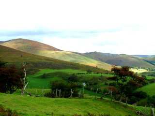
Extensive upland heath with heather, gorse, bilberry, bracken and rushes, with some areas of improved pasture. The area lies between a height of 300–580 metres above sea level, with an underlying geology of Silurian shales, forming a long ridge running in a north-easterly to south-westerly direction.The early environmental history of the area since the last glaciation has been little studied but some indication of early prehistoric activity is indicated by the chance discovery of a stone axe from near Moel y Gaer hillfort and by Bronze Age hilltop burial monuments on Moel y Gamelin and Gribin Oernant. These monuments, together with the probably Iron Age hillfort at Moel y Gaer are probably to be associated with the early exploitation of upland pastures for grazing.
The former management of parts of the area as a grouse moor is indicated by dispersed shooting butts. Today, the area is mostly unenclosed common land, formerly managed for sheep grazing and as a grouse moor. The area has a number of modern recreational uses including hill walking and illegal motorbike scrambling.
The area includes a number of small stone quarries, probably for building materials in the post-medieval period.
Sources
Burnham 1995; CPAT Historic Environment Record; Davies 1929; Denbighshire Countryside Service 2003b; Ellis 1924; Jones 1999; Hogg 1979; Richards 1969For further information please contact the Clwyd-Powys Archaeological Trust at this address, or link to the Countryside Council for Wales web site at www.ccw.gov.uk.
Privacy and cookies